Cancelled - The National Weather Service radar shows that the forecasted precipitation is at our door step.
Let's be optimistic, just in case we get a window of opportunity. We'll plan on riding the National Forest Trails to the west of the Cedar Creek and Birch Hill neighborhoods off West Side Road in North Conway. There are two "loops" which combine about 8 miles of mostly forest roads and about 3 miles of pavement. The total time to do both loops at a moderate pace, is a couple of hours
Most of the ride is pretty flat and suitable for all abilities. We will cross a couple of brooks, but most of us will keep our feet dry.
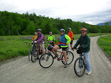
We'll meet at 9:30am in the parking lot just outside and to the left of the gates to Echo Lake State Park in North Conway. From there we'll ride south on West Side Road for about 3 miles and then enter The National Forest on a trail in the Cedar Creek Development. Bug spray is recommended.
Check this blog at 8am tomorrow, Tuesday, morning to confirm that the ride is still on.
Monday, May 31, 2010
Thursday, May 20, 2010
Dam and Dummer
Monday Update:
I've had several inquiries about carpooling for tomorrow's ride. We'll meet at 8:50am at The Old Jackson Town Hall which is across the street from the Post Office and School.
Don't miss this ride!
It will be one of the top three rides of the season!!! Along the way there will be plenty of oohs and aahs accompanied by a couple of wows. There's lots of water and lots of fabulous views. In fact I guarantee a minimum of one eye popping moment per person.
The ride starts across the street from the Berlin Airport. We'll go north on the rural and quiet East Side River Road which closely follows the Androscoggin River and has wonderful views. Next we'll turn right onto Hill Street a dirt road, which gently rises through woods and farm lands and takes us around the Dummer Loop and back to East Side River Road. From here we'll head to The Pontook Dam on neat dirt roads which parallel a hydropower canal before getting us to the seldom seen east side of the Pontook Dam and reservoirs. Before starting our return on East Side River Road we'll stop by the hydro station south of the dam where there is a lovely water front spot for lunch.
To see the map of this 18 mile ride click here:
http://www.mapmyride.com/ride/united-states/nh/-milan/478127439602389259
Take route 16 north through Berlin. About 3 miles past Nansen Wayside Park (old ski jump on the left and waterfront park on right), Bridge Street will be on the right. You should also see an airport sign pointing right too. Cross over the Androscoggin River and at the end of Bridge Street pull into the ball park lot on your left.
Please be ready to ride at 10:00am Tuesday May 25th. See you there for a very special ride.
Monday, May 17, 2010
FRYEBURG BLACK AND TAN
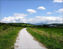
What could be more beautiful than a bike ride among the farm lands and river beds of Fryeburg on a sunny spring day? This easy and virtually flat 15 mile ride is part pavement (black) and part dirt (tan), hence the route's name Fryeburg Black and Tan. Click here to view the route map.
http://www.mapmyride.com/route/us/me/fryeburg/190127409972981564#success
After a few miles of riding by the fields of North Fryeburg we'll head to The Hemlock Covered Bridge on River Road and then Frog Alley. On the way back to North Fryeburg there will be the option to ride off road for about a mile on a trail that parallels Frog Alley.
We'll meet tomorrow morning, May 18th at 10:00am, ready to ride, at the park next to the Saco Valley Fire Station in North Fryeburg, at the corner of Route 113 and South Chatham Road. Do not park in front of the fire station, park on the side of the road next to the park. Bring lunch, water, sunscreen and bugspray. On Sunday there weren't many bugs, but there was a breeze which may have grounded the little buggers.
Sunday, May 9, 2010
A New Season
The weather forecast for Tuesday is great. It is supposed to be sunny with light winds and in the upper 50’s, which sounds like great cruising conditions. Let’s try something we didn't get to last year, Lincoln Woods. It’s perfect for a season opener as it’s easy and quite scenic. Also it is a very highly traveled trail in the summer and fall, but we’ll have it virtually to ourselves at this time of year.
First we’ll cruise out on the East Side Trail, which parallels the eastern shore of the Pemigewasset River, through the woods for 3 miles until we reach the Wilderness Area where bikes are not permitted. Then we’ll retrace our route back and take the Lincoln Woods Trail for 3 miles which follows the western shore of the Pemigewasset River and has great river vistas. After a picnic lunch we’ll retrace our route again back to the Lincoln Woods parking lot.
The East Side Trail is a forest service road and it follows the contours of the woods, so there are short hills along the way. There may be some spots where the gravel is a bit loose. The Lincoln Woods Trail follows an old railroad bed so it is quite flat. There are ties still embedded in the path but they are easily avoided. So keep your eyes on those ties! Mud, as always, is a distinct possibility so plan you foot wear accordingly.
In all we’ll cover about 12 miles. Those who want a shorter ride can go back to the parking lot after 6 miles. Plan on having lunch on the shore of the river or if we are still feeling frisky after 9 miles of riding we can walk to Franconia Falls which is .4 mi off the Lincoln Woods trail.
Please be ready to ride from the Lincoln Woods parking lot at 10:00am Tuesday morning May 11th. Parking permits are required here, but I doubt anyone will be checking, since the information cabin will not be open yet. Take the Kanc (route 112) west. The visitor center is on the right about four miles before you get to “downtown Lincoln”. See you there, Joan
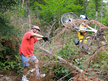
PS. Bear Notch Road is not open yet. I contacted NH DOT Friday and I received this response "We are currently dealing with substantial blow down of trees from the weather of this past winter and have been delayed twice by additional snow fall. We are cutting and chipping as we speak, making our way to the Rt.112 side. My hope is that within two weeks we will be ready to open the road, barring no further delays."
Subscribe to:
Comments (Atom)


