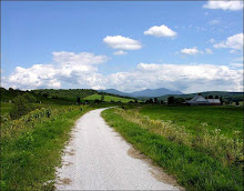
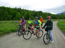
Let's ride from The White Mountain Cider Company to the Rocky Branch Shelter #1 via Allen and Jericho roads. This is about a 13 mile ride which retraces most of the lower half of the Rocky Branch Logging Railroad that operated from 1908 to 1914. We'll ride on dirt roads and dirt trails most of the way. Be prepared to get your feet and legs wet when we cross from Allen Street over the river toward Jericho Road. It's a short crossing, but expect to hit a small pocket of water that is a foot and a half deep.
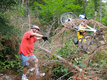
This is not your usual (relatively smooth) rail trail. There will be rough patches, trees across the way and waterbars which may necessitate getting off our bikes to maneuver safely. The return ride will be mostly down hill and a lot of fun.
Meet in the back of the parking lot at The White Mountain Cider Company on route 302 in Glen at 9:30. Bring lunch (or buy it at the Cider Co. Deli), sunscreen and water.
Click below for a map of the ride:
http://www.mapmyride.com/route/us/nh/bartlett/glen/723128007526281484
Sunday, July 25, 2010
Monday, July 19, 2010
Scenic Ammonoosuc
The Ammonoosuc Rail Trail from Littleton to Lisbon was one of the favorite rides we did last year. It is a multi-use rail trail that runs about 20 miles between Woodsville and Littleton along the Ammonoosuc River. Tomorrow July 20th we'll ride on half of the trail from Littleton to Lisbon for about 22 miles out and back, on this almost flat route which wends its way through bucolic woods and farm lands by the Ammonoosuc River. We’ll save the other half of the ride for a later date this year. There may be some ATV or dirt bike riders that will be on the trail with us, although I don't expect there will be many of these vehicles on a week day. If you are so inclined you can cool off in the Ammonoosuc after the ride at the very scenic swimming hole next to the lot where we’ll park our cars.
Littleton is a neat little town. After we ride we can visit Bishops Homemade Ice Cream Shop. Yankee Magazine rated it one of the top five ice cream stands in New England. Need I say more? Also there's Chuttters which boasts the "world’s longest candy counter". Even if you’re not a big candy fan it is quite a sight and worth a visit. Other historic points of interest include Thayers Inn which was built in 1850. Common areas and a couple of rooms are open for viewing. Five Presidents and countless celebrities and national politicians have been guests at Thayers Inn. And there's the Littleton Grist Mill which is a restored 1798 working mill and museum. All of these attractions are in the bustling downtown area and are a short walk from our cars which will be parked behind the Littleton Bike shop in their parking lot.
Bring: plenty of water, sunscreen, and lunch
Directions: Take route 302 northwest to Bethlehem and get on route 93 northbound. At exit 41 head north on route 302 towards downtown Littleton. In about ¾ of a mile The Littleton Bike Shop will be on the left. It is 23 Cottage Street (route 302). Take the driveway/road just before the bike shop building and park in back.
Carpooling: Meet in the Attitash parking lot at 8:15.
To view a map of the whole trail click here: http://www.mapmyride.com/ride/united-states/nh/littleton/431124924892788898:
Be ready to ride at 9:30 in Littleton
Sunday, July 11, 2010
Great Glen Trails
Let's go up to Pinkham Notch on Route 16 to try something completely different at Great Glen Trails. On Tuesday July 13th we'll meet in the parking lot near the front entrance at 9:30am, then buy our day passes and go to the bike shop to develop a group ride plan. The listed daily fee is $8, but if everyone who has a Kiwanis Coupon Book can bring the 2 for 1 Great Glen Trails coupon, we should be able to get everyone in for $4.
There are many types of trails to choose from. We'll explore the easy and intermediate paths and carriage roads as well as some single track and perhaps the pump track before our picnic lunch at a suitably scenic spot. There is a cafe and you can buy your lunch or you can brown bag it. I suspect that we'll all visit the cafe for an after ride "treat". Also for those who want to explore more trails your day pass will be good until 3:30.
Directions: Go north on route 16 to Pinkham Notch. Since this is almost a "local" ride we will not have a carpooling rendez vous spot.
If you have a coupon book please remember to bring it!
If the weather forecast deteriorates please check back here at 8am Tuesday morning.
Sunday, July 4, 2010
Warren Rail Trail Blast Off!
Last fall I discovered (for myself) a really nice new rail trail in Warren, NH. Its going to be hot and humid tomorrow so this shady, woodsy ride will fit the bill. But don't take my word for it see the trail description from Traiklink.com below.
This popular trail starts from an interesting landmark: a Redstone missile brought to Warren by a resident who served in the Army in Alabama in 1970. He found some obsolete missiles in a field and arranged with the Army to transport one back to Warren, aiming to bring something of America's thriving (and far-removed) space program closer to local youth. Placed in the town center in 1971, it remains a prominent fixture.
The rail-trail (a.k.a. the Jesse E. Bushaw Memorial Trail or New Hampshire Snowmobile Corridor No. 5) is a pleasant and picturesque 9.4-mile multipurpose route. The hard-packed dirt surface is generally wide, smooth, and flat, and motorized use is permitted, making it popular among ATV riders in summer and snowmobilers in winter. The trail also welcomes walkers, bikers, equestrians, and anglers eager to try their luck in trailside brooks and ponds.
While most of the route is straight with few technical obstacles, between miles 6 and 7, the trail dips and climbs steeply as it diverges from the railbed to follow State Route 25. Where it rejoins the corridor, the route again runs straight and flat.
Around mile 8, just after you pass the concrete cubes protecting this section of the trail from motorized use, you'll enter the Oliverian Valley Wildlife Preserve's Habitat Management Demonstration Area. Viewing platforms on either side of the path help you keep an eye out for birds and other wildlife.
In the final mile, the trail passes under power lines, swings to the right, and crosses a brook. You'll emerge on State Route 25 in East Haverhill between the Oliverian Valley Campground and a baseball field. This trailhead is difficult to find, so begin your journey in Warren.
Last fall, on this 19 mile roundtrip ride, we past a few walkers and bikers on the Warren end of the path but otherwise Chumley and I had it all to ourselves with no motorized traffic.
Directions: Take the Kanc (route 112) to North Woodstock go across route 3 and continue on route 112 for 2.6 miles. Take a left onto route 118 which will take you to Warren. Look for the upright missile in downtown Warren and we'll figure out parking from there.
Carpooling: For those people who will use Bear Notch Road meet at the Attitash parking lot at 8:00 am. Please email me at chumley@earthlink.net if you plan to start over the Kanc in Conway and you want to carpool.
We should be ready to start the ride at 9:30am.
Map link:http://www.mapmyride.com/ride/united-states/nh/-warren/897125621736444678
Bring plenty of water, lunch and bug spray.
Subscribe to:
Comments (Atom)


