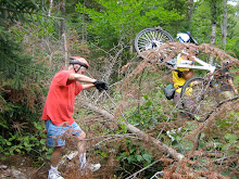
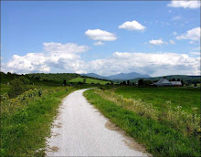
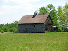
Join Marianne as she leads the group on a discovery adventure to a new and historical area, the Pond of Safety in Jefferson. Expect the unexpected; "walkable hills", fabulous views, rough patches, wildlife sightings, downed trees or other obstacles, plus the collective thrill of finding a new ride together. Bring lunch, bug dope, water and a sense of adventure. While the group will determine the exact route this map will give you a sense of the possible route. http://www.mapmyride.com/route/us/nh/jefferson/155127651369552241
Below is Marianne's write up.
Meet at the corner of Valley Road and Route 115 in Jefferson at 10:00 am. Drive there via route 302; turn right at the lights onto route 3 in Twin Mountain, then after about 1 mile turn right again onto Route 115. Climb up 115, and eventually the views open up, and there is a scenic vista on the left. Valley Road is about 4 miles after the scenic vista, on the right side of Route 115. It is about 1 mile after route 115A turns left to head towards the Waumbec Golf Club. Turn right onto Valley Road and park off the road in the dirt shoulder near the intersection. We will meet here and proceed either by car to the trailhead or ride our bikes.
The Pond of Safety is reached by about a 3 mile ride on a dirt road that is slightly uphill all the way. The road begins off of Route 2 near Six Gun City. On the way back we can stop for snacks at the Israel River Campground, and if anyone has not seen the lupines on Valley Road, we can do that, too.
Carpool: Meet at the Attitash parking lot at 9:15.
There is an interesting history of this pond:
The info below is copied from: http://www.randolphmountainclub.org/multimedia/publications/foursoldiers/foursoldiers2.html
The Legend of the Four Soldiers
The Name “Four Soldiers” comes from the days of the American Revolution. It is said that four Continental Army soldiers,William Danforth, Benjamin Hicks, Lazarus Holmes, and Capt. James Ryder, were captured by the British and then released under the condition that they would fight against them no more.
For fear of being arrested if they refused combat upon return, the four soldiers escaped and fled home to the North Country, finding their way to the remote pond, where they lived in safety for more than three years, until the war ended. At the war’s end, the four soldiers were exonerated of their charges of desertion and welcomed back to civilization.
From one generation to the next this legend is passed along. Randolph Paths, Randolph Old and New, other mountain guidebooks, and writings about Randolph and Coos County include versions of this tale of the Four Soldiers at Pond of Safety.
Monday, June 14, 2010

Sunday, June 6, 2010
Pondicherry - The Lupine Tour
The weather forecast looks great for Tuesday! Let's do an amazingly scenic ride in the Randolph-Jefferson valley area. The route follows the Presidential Rail Trail into The Pondicherry National Wildlife refuge for most of the way. We will ride the rail trail for 2 miles and then cut over to Valley Road which is a smooth, scenic dirt road. The lupines are blooming in the fields and they will make the rural country views absolutely beautiful. After 3 miles on Valley Road, we will reunite with the rail trail again at its intersection with route 115 and follow it 4.5 miles into the Pondicherry Wildlife National Refuge. This area has great scenery and panoramic views of the Presidentials and magazine-worthy photographic opportunities. On the return, we can retrace our route or ride some pavement on Israel's River Road as a change of venue for awhile. Total Mileage out and back is about 18.5 flat miles.
Start time: 10:00 am, ready to bike.
The ride will start at the Bowman parking area (hikers parking for the Castle trail) on the left (south) side of Route 2. From the Conway area, drive north over Pinkham Notch on route 16. Take a left onto Route 2, drive through downtown Gorham then take a left again on Route 2 as it heads west towards Randolph. Drive about 8.4 miles to the Castle Trail parking area, on the left. It is about 3 miles west of the Appalachia trail head parking area. Bring water, lunch, camera and bug defense.
To view the route, click this link:
http://www.mapmyride.com/ride/united-states/nh/randolph/275124485600141373
For those heading to the Bowman parking area and wishing to carpool, meet at the Jackson XC/Wentworth GC parking lot directly across from the J-Town Deli at 8:55am.
Need more miles after looking out the window at the rain? Marianne is contemplating a ride extension. Does anyone want to join her and start from the east end of the Pinkham B Road? This will add 18 miles to the day, and it includes a climb on Pinkham B and a ride on Durand Road, which is parallel to and north of Route 2. Durand Road ends about 1/2 mile before the Bowman trail parking area. Meet the rest of the riders at Bowman ready to ride at 10:00 after this "warm-up". Call or email Marianne if you want to do these extra 18 miles: 383-9232 or marianneborowski@yahoo.com.
Start time: 10:00 am, ready to bike.
The ride will start at the Bowman parking area (hikers parking for the Castle trail) on the left (south) side of Route 2. From the Conway area, drive north over Pinkham Notch on route 16. Take a left onto Route 2, drive through downtown Gorham then take a left again on Route 2 as it heads west towards Randolph. Drive about 8.4 miles to the Castle Trail parking area, on the left. It is about 3 miles west of the Appalachia trail head parking area. Bring water, lunch, camera and bug defense.
To view the route, click this link:
http://www.mapmyride.com/ride/united-states/nh/randolph/275124485600141373
For those heading to the Bowman parking area and wishing to carpool, meet at the Jackson XC/Wentworth GC parking lot directly across from the J-Town Deli at 8:55am.
Need more miles after looking out the window at the rain? Marianne is contemplating a ride extension. Does anyone want to join her and start from the east end of the Pinkham B Road? This will add 18 miles to the day, and it includes a climb on Pinkham B and a ride on Durand Road, which is parallel to and north of Route 2. Durand Road ends about 1/2 mile before the Bowman trail parking area. Meet the rest of the riders at Bowman ready to ride at 10:00 after this "warm-up". Call or email Marianne if you want to do these extra 18 miles: 383-9232 or marianneborowski@yahoo.com.
Monday, May 31, 2010
Iffy Forecast for June 1st
Cancelled - The National Weather Service radar shows that the forecasted precipitation is at our door step.
Let's be optimistic, just in case we get a window of opportunity. We'll plan on riding the National Forest Trails to the west of the Cedar Creek and Birch Hill neighborhoods off West Side Road in North Conway. There are two "loops" which combine about 8 miles of mostly forest roads and about 3 miles of pavement. The total time to do both loops at a moderate pace, is a couple of hours
Most of the ride is pretty flat and suitable for all abilities. We will cross a couple of brooks, but most of us will keep our feet dry.
We'll meet at 9:30am in the parking lot just outside and to the left of the gates to Echo Lake State Park in North Conway. From there we'll ride south on West Side Road for about 3 miles and then enter The National Forest on a trail in the Cedar Creek Development. Bug spray is recommended.
Check this blog at 8am tomorrow, Tuesday, morning to confirm that the ride is still on.
Let's be optimistic, just in case we get a window of opportunity. We'll plan on riding the National Forest Trails to the west of the Cedar Creek and Birch Hill neighborhoods off West Side Road in North Conway. There are two "loops" which combine about 8 miles of mostly forest roads and about 3 miles of pavement. The total time to do both loops at a moderate pace, is a couple of hours
Most of the ride is pretty flat and suitable for all abilities. We will cross a couple of brooks, but most of us will keep our feet dry.
We'll meet at 9:30am in the parking lot just outside and to the left of the gates to Echo Lake State Park in North Conway. From there we'll ride south on West Side Road for about 3 miles and then enter The National Forest on a trail in the Cedar Creek Development. Bug spray is recommended.
Check this blog at 8am tomorrow, Tuesday, morning to confirm that the ride is still on.
Thursday, May 20, 2010
Dam and Dummer
Monday Update:
I've had several inquiries about carpooling for tomorrow's ride. We'll meet at 8:50am at The Old Jackson Town Hall which is across the street from the Post Office and School.
Don't miss this ride!
It will be one of the top three rides of the season!!! Along the way there will be plenty of oohs and aahs accompanied by a couple of wows. There's lots of water and lots of fabulous views. In fact I guarantee a minimum of one eye popping moment per person.
The ride starts across the street from the Berlin Airport. We'll go north on the rural and quiet East Side River Road which closely follows the Androscoggin River and has wonderful views. Next we'll turn right onto Hill Street a dirt road, which gently rises through woods and farm lands and takes us around the Dummer Loop and back to East Side River Road. From here we'll head to The Pontook Dam on neat dirt roads which parallel a hydropower canal before getting us to the seldom seen east side of the Pontook Dam and reservoirs. Before starting our return on East Side River Road we'll stop by the hydro station south of the dam where there is a lovely water front spot for lunch.
To see the map of this 18 mile ride click here:
http://www.mapmyride.com/ride/united-states/nh/-milan/478127439602389259
Take route 16 north through Berlin. About 3 miles past Nansen Wayside Park (old ski jump on the left and waterfront park on right), Bridge Street will be on the right. You should also see an airport sign pointing right too. Cross over the Androscoggin River and at the end of Bridge Street pull into the ball park lot on your left.
Please be ready to ride at 10:00am Tuesday May 25th. See you there for a very special ride.
I've had several inquiries about carpooling for tomorrow's ride. We'll meet at 8:50am at The Old Jackson Town Hall which is across the street from the Post Office and School.
Don't miss this ride!
It will be one of the top three rides of the season!!! Along the way there will be plenty of oohs and aahs accompanied by a couple of wows. There's lots of water and lots of fabulous views. In fact I guarantee a minimum of one eye popping moment per person.
The ride starts across the street from the Berlin Airport. We'll go north on the rural and quiet East Side River Road which closely follows the Androscoggin River and has wonderful views. Next we'll turn right onto Hill Street a dirt road, which gently rises through woods and farm lands and takes us around the Dummer Loop and back to East Side River Road. From here we'll head to The Pontook Dam on neat dirt roads which parallel a hydropower canal before getting us to the seldom seen east side of the Pontook Dam and reservoirs. Before starting our return on East Side River Road we'll stop by the hydro station south of the dam where there is a lovely water front spot for lunch.
To see the map of this 18 mile ride click here:
http://www.mapmyride.com/ride/united-states/nh/-milan/478127439602389259
Take route 16 north through Berlin. About 3 miles past Nansen Wayside Park (old ski jump on the left and waterfront park on right), Bridge Street will be on the right. You should also see an airport sign pointing right too. Cross over the Androscoggin River and at the end of Bridge Street pull into the ball park lot on your left.
Please be ready to ride at 10:00am Tuesday May 25th. See you there for a very special ride.
Monday, May 17, 2010
FRYEBURG BLACK AND TAN
What could be more beautiful than a bike ride among the farm lands and river beds of Fryeburg on a sunny spring day? This easy and virtually flat 15 mile ride is part pavement (black) and part dirt (tan), hence the route's name Fryeburg Black and Tan. Click here to view the route map.
http://www.mapmyride.com/route/us/me/fryeburg/190127409972981564#success
After a few miles of riding by the fields of North Fryeburg we'll head to The Hemlock Covered Bridge on River Road and then Frog Alley. On the way back to North Fryeburg there will be the option to ride off road for about a mile on a trail that parallels Frog Alley.
We'll meet tomorrow morning, May 18th at 10:00am, ready to ride, at the park next to the Saco Valley Fire Station in North Fryeburg, at the corner of Route 113 and South Chatham Road. Do not park in front of the fire station, park on the side of the road next to the park. Bring lunch, water, sunscreen and bugspray. On Sunday there weren't many bugs, but there was a breeze which may have grounded the little buggers.
http://www.mapmyride.com/route/us/me/fryeburg/190127409972981564#success
After a few miles of riding by the fields of North Fryeburg we'll head to The Hemlock Covered Bridge on River Road and then Frog Alley. On the way back to North Fryeburg there will be the option to ride off road for about a mile on a trail that parallels Frog Alley.
We'll meet tomorrow morning, May 18th at 10:00am, ready to ride, at the park next to the Saco Valley Fire Station in North Fryeburg, at the corner of Route 113 and South Chatham Road. Do not park in front of the fire station, park on the side of the road next to the park. Bring lunch, water, sunscreen and bugspray. On Sunday there weren't many bugs, but there was a breeze which may have grounded the little buggers.
Sunday, May 9, 2010
A New Season
The weather forecast for Tuesday is great. It is supposed to be sunny with light winds and in the upper 50’s, which sounds like great cruising conditions. Let’s try something we didn't get to last year, Lincoln Woods. It’s perfect for a season opener as it’s easy and quite scenic. Also it is a very highly traveled trail in the summer and fall, but we’ll have it virtually to ourselves at this time of year.
First we’ll cruise out on the East Side Trail, which parallels the eastern shore of the Pemigewasset River, through the woods for 3 miles until we reach the Wilderness Area where bikes are not permitted. Then we’ll retrace our route back and take the Lincoln Woods Trail for 3 miles which follows the western shore of the Pemigewasset River and has great river vistas. After a picnic lunch we’ll retrace our route again back to the Lincoln Woods parking lot.
The East Side Trail is a forest service road and it follows the contours of the woods, so there are short hills along the way. There may be some spots where the gravel is a bit loose. The Lincoln Woods Trail follows an old railroad bed so it is quite flat. There are ties still embedded in the path but they are easily avoided. So keep your eyes on those ties! Mud, as always, is a distinct possibility so plan you foot wear accordingly.
In all we’ll cover about 12 miles. Those who want a shorter ride can go back to the parking lot after 6 miles. Plan on having lunch on the shore of the river or if we are still feeling frisky after 9 miles of riding we can walk to Franconia Falls which is .4 mi off the Lincoln Woods trail.
Please be ready to ride from the Lincoln Woods parking lot at 10:00am Tuesday morning May 11th. Parking permits are required here, but I doubt anyone will be checking, since the information cabin will not be open yet. Take the Kanc (route 112) west. The visitor center is on the right about four miles before you get to “downtown Lincoln”. See you there, Joan
PS. Bear Notch Road is not open yet. I contacted NH DOT Friday and I received this response "We are currently dealing with substantial blow down of trees from the weather of this past winter and have been delayed twice by additional snow fall. We are cutting and chipping as we speak, making our way to the Rt.112 side. My hope is that within two weeks we will be ready to open the road, barring no further delays."
First we’ll cruise out on the East Side Trail, which parallels the eastern shore of the Pemigewasset River, through the woods for 3 miles until we reach the Wilderness Area where bikes are not permitted. Then we’ll retrace our route back and take the Lincoln Woods Trail for 3 miles which follows the western shore of the Pemigewasset River and has great river vistas. After a picnic lunch we’ll retrace our route again back to the Lincoln Woods parking lot.
The East Side Trail is a forest service road and it follows the contours of the woods, so there are short hills along the way. There may be some spots where the gravel is a bit loose. The Lincoln Woods Trail follows an old railroad bed so it is quite flat. There are ties still embedded in the path but they are easily avoided. So keep your eyes on those ties! Mud, as always, is a distinct possibility so plan you foot wear accordingly.
In all we’ll cover about 12 miles. Those who want a shorter ride can go back to the parking lot after 6 miles. Plan on having lunch on the shore of the river or if we are still feeling frisky after 9 miles of riding we can walk to Franconia Falls which is .4 mi off the Lincoln Woods trail.
Please be ready to ride from the Lincoln Woods parking lot at 10:00am Tuesday morning May 11th. Parking permits are required here, but I doubt anyone will be checking, since the information cabin will not be open yet. Take the Kanc (route 112) west. The visitor center is on the right about four miles before you get to “downtown Lincoln”. See you there, Joan
PS. Bear Notch Road is not open yet. I contacted NH DOT Friday and I received this response "We are currently dealing with substantial blow down of trees from the weather of this past winter and have been delayed twice by additional snow fall. We are cutting and chipping as we speak, making our way to the Rt.112 side. My hope is that within two weeks we will be ready to open the road, barring no further delays."
Saturday, April 10, 2010
Season Opener
It's time to dust off those bikes and feed them some chain oil. We'll start the first ride on Tuesday morning May 11th, if the weather cooperates. So stayed tuned for details.
Subscribe to:
Posts (Atom)