If the weather cooperates how about a ride on Rob Brook Road? Two weeks ago this ride was posted, but Fred was the only one to show up. Kudos to Fred! So let's try to do it again. Check back Tuesday around 8am if the weather looks iffy.
The Rob Brook Road Loop is a valley classic. This area has a reputation for being buggy. Three years ago when we rode this route in July it lived up to its reputation. But the bugs have left us for the most part and its time we got out there for a very pleasant ride. This is a rolling 12 mile ride, suitable for all abilities, mostly on a winding dirt forest road with the last few miles on the Kanc and Bear Notch Road. There are small hills to climb and even though it's one of our shorter rides. you (and your gears) will get a good workout on this ride.
Marty Basch describes this ride in his White Mountain Ride Guide as follows "The road winds by streams and huge boulders. Spotting signs of moose and deer are common. A few quick climbs are rewarded with refreshing downhills."
Plan on getting your feet wet as you need to cross the Swift River to get to the Kanc. You may want to bring an extra pair of shoes to get you across the river. Just after you cross the river look slightly right and follow that path a short way to the Kanc. Go left (east) on the Kanc.
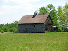
A good lunch spot is at The Russell Colbath House (on The Kanc) where there are picnic benches by the barn. After lunch continue eastward on the Kanc until Bear Notch Road appears on the left.
The Trail Head and parking are on the west side of Bear Notch Road .75 mi north of the intersection with The Kanc. Meet at the trailhead at 10:00am.
Saturday, September 29, 2012

Sunday, September 23, 2012
Pondicherry
The weather forecast looks great for Tuesday September 25th! Let's do an amazingly
scenic ride in Jefferson and check out the fall colors.
We’ll start at the western terminus of The Presidential Range Rail Trail and pedal through almost four miles of The Pondicherry National Wildlife Refuge where the views are absolutely magnificent. Then we’ll head for more open vistas on three miles of paved country road and another three plus miles on the dirt Valley Road. When we reach Jefferson Notch Road we will return to Pondicherry on The Rail Trail. In all we’ll cover about 18 miles with breath taking views and the fall foliage colors.
The rail trail has a pretty firm surface and is a combination of dirt, gravel, stone, cinder and ballast. This is a relatively flat route with no major hills. It’s just a wonderful cruise through a beautiful area.
Directions: Take route 302 through Bretton Woods and at the traffic light go right on route 3 for 1.9 miles. Then take another right on route 115. In 4.4 miles Hazen Road will be on your left, take it. In another 1.4 miles you will see a sign on the right saying Presidential Recreation Trail Pondicherry. Go right into the small parking lot. We may have to do some creative parking to fit us all in here.
Carpooling is a must due to the small parking lot at Pondicherry. Meet at 9:00am at the far west end of the Attitash parking lot. Please be ready to ride at 10:00am.
Click here for a map of this ride.
http://www.mapmyride.com/routes/view/11313897
We’ll start at the western terminus of The Presidential Range Rail Trail and pedal through almost four miles of The Pondicherry National Wildlife Refuge where the views are absolutely magnificent. Then we’ll head for more open vistas on three miles of paved country road and another three plus miles on the dirt Valley Road. When we reach Jefferson Notch Road we will return to Pondicherry on The Rail Trail. In all we’ll cover about 18 miles with breath taking views and the fall foliage colors.
The rail trail has a pretty firm surface and is a combination of dirt, gravel, stone, cinder and ballast. This is a relatively flat route with no major hills. It’s just a wonderful cruise through a beautiful area.
Directions: Take route 302 through Bretton Woods and at the traffic light go right on route 3 for 1.9 miles. Then take another right on route 115. In 4.4 miles Hazen Road will be on your left, take it. In another 1.4 miles you will see a sign on the right saying Presidential Recreation Trail Pondicherry. Go right into the small parking lot. We may have to do some creative parking to fit us all in here.
Carpooling is a must due to the small parking lot at Pondicherry. Meet at 9:00am at the far west end of the Attitash parking lot. Please be ready to ride at 10:00am.
Click here for a map of this ride.
http://www.mapmyride.com/routes/view/11313897
Sunday, September 16, 2012
Rob Brook Road
If the weather cooperates how about a ride on Rob Brook Road? I'm still on The Cape so I won't join you until next week. Here's the description.
The Rob Brook Road Loop is a valley classic. This area has a reputation for being buggy. Three years ago when we rode this route in July it lived up to its reputation. But the bugs have left us for the most part and its time we got out there for a very pleasant ride. This is a rolling 12 mile ride, suitable for all abilities, mostly on a winding dirt forest road with the last few miles on the Kanc and Bear Notch Road. There are hills to climb but they are quite doable.
Marty Basch describes this ride in his White Mountain Ride Guide as follows "The road winds by streams and huge boulders. Spotting signs of moose and deer are common. A few quick climbs are rewarded with refreshing downhills."
Plan on getting your feet wet as you need to cross the Swift River to get to the Kanc. Just after you cross the river look slightly right and follow that path a short way to the Kanc. Go left (east) on the Kanc. A good lunch spot is at The Russell Colbath House (on The Kanc) where there are picnic benches by the barn. After lunch continue eastward on the Kanc until Bear Notch Road appears on the left.
The Trail Head and parking are on the west side of Bear Notch Road .75 mi north of the intersection with The Kanc. Meet at the trailhead at 10:00am.
The Rob Brook Road Loop is a valley classic. This area has a reputation for being buggy. Three years ago when we rode this route in July it lived up to its reputation. But the bugs have left us for the most part and its time we got out there for a very pleasant ride. This is a rolling 12 mile ride, suitable for all abilities, mostly on a winding dirt forest road with the last few miles on the Kanc and Bear Notch Road. There are hills to climb but they are quite doable.
Marty Basch describes this ride in his White Mountain Ride Guide as follows "The road winds by streams and huge boulders. Spotting signs of moose and deer are common. A few quick climbs are rewarded with refreshing downhills."
Plan on getting your feet wet as you need to cross the Swift River to get to the Kanc. Just after you cross the river look slightly right and follow that path a short way to the Kanc. Go left (east) on the Kanc. A good lunch spot is at The Russell Colbath House (on The Kanc) where there are picnic benches by the barn. After lunch continue eastward on the Kanc until Bear Notch Road appears on the left.
The Trail Head and parking are on the west side of Bear Notch Road .75 mi north of the intersection with The Kanc. Meet at the trailhead at 10:00am.
Saturday, September 1, 2012
Monday, August 20, 2012
Wild River Ride
It's been almost a year since Irene ripped through the White Mountains and the Wild River lived up to it's name. Last year we viewed the awesome changes that resulted from the deluge in the Wild River Valley. One of the suspension bridges across the river was completely blown out, the other survived although it also was damaged. The dirt Wild River Road was washed out in many places and the campground was not there anymore. The Wild River Trail which went from the campground into the Wilderness Area was underminded and gouged out on the way to a gargantuan mass of trees and other debris which created an impenetrable wall that cut off the trail.
This Tuesday August 21st, let's revisit the beautiful Wild River Valley and see what The Forest Service and it's contractors have been up to in the last 51 weeks. The road has been rebuilt and the campground is back in action, but I bet that staggering mountain of trees and debris is still there. Check out the Forest Service's website which has before and after photos of Wild River Road.
http://www.fs.usda.gov/Internet/FSE_DOCUMENTS/stelprdb5382177.pdf
From the ride's starting point on Route 2 just before the intersection of Route 113 we'll ride about 3 miles up to Wild River Road. We may encounter a few cars on Route 113, but weekday traffic should be light. As we bike the almost 6 miles to the campground we’ll still get a sense of the force of the flood waters and the large scale repairs that have been made. In all we’ll cover something like 18 miles on this out and back ride. This ride generally follows the old Wild River Railroad route into this area. So the riding is pretty easy although it isn't flat and there are some hills. As we go into the valley the road rises gradually and the return is a very fun downward ride.
Directions: Go to Gorham on route 16 north. At the Route 2 intersection go right toward Maine. About 2 (I think it’s 1.9) miles beyond the Maine State line take a right onto a dirt road which leads to the site of the old bridge and a large parking area. If you get to the new bridge which is just beyond our turn off you’ve gone too far. And if you get to Route 113, on the right, just over the new bridge you’ll know you’ve over shot the starting point.
Let’s start the ride at 10:00am. It’s going to be a beautiful day and we can have a picnic lunch along the river. If anyone wants to carpool meet at the Jackson Old Town Hall parking lot across from the post office at 9am. Don't forget to bring your lunch and some water.
This Tuesday August 21st, let's revisit the beautiful Wild River Valley and see what The Forest Service and it's contractors have been up to in the last 51 weeks. The road has been rebuilt and the campground is back in action, but I bet that staggering mountain of trees and debris is still there. Check out the Forest Service's website which has before and after photos of Wild River Road.
http://www.fs.usda.gov/Internet/FSE_DOCUMENTS/stelprdb5382177.pdf
From the ride's starting point on Route 2 just before the intersection of Route 113 we'll ride about 3 miles up to Wild River Road. We may encounter a few cars on Route 113, but weekday traffic should be light. As we bike the almost 6 miles to the campground we’ll still get a sense of the force of the flood waters and the large scale repairs that have been made. In all we’ll cover something like 18 miles on this out and back ride. This ride generally follows the old Wild River Railroad route into this area. So the riding is pretty easy although it isn't flat and there are some hills. As we go into the valley the road rises gradually and the return is a very fun downward ride.
Directions: Go to Gorham on route 16 north. At the Route 2 intersection go right toward Maine. About 2 (I think it’s 1.9) miles beyond the Maine State line take a right onto a dirt road which leads to the site of the old bridge and a large parking area. If you get to the new bridge which is just beyond our turn off you’ve gone too far. And if you get to Route 113, on the right, just over the new bridge you’ll know you’ve over shot the starting point.
Let’s start the ride at 10:00am. It’s going to be a beautiful day and we can have a picnic lunch along the river. If anyone wants to carpool meet at the Jackson Old Town Hall parking lot across from the post office at 9am. Don't forget to bring your lunch and some water.
Monday, August 13, 2012
Gorge(ous) Lovell
It’s the height of the tourist season. Has anyone else noticed the epic backups going into and out of North Conway? So tomorrow, August 14th, we need to get far from the madding crowds. And there’s nowhere more remote and scenic as the Kezar Falls Gorge /Five Kezar Ponds area out of Lovell, Maine. You’ll be surprised at the remoteness of the second half of the ride.
We'll start out at the Lovell Historical Society and take Old Waterford Road to Kezar Falls Gorge, which Delorme rightly describes as a unique natural area. Then the route will take us to the Five Kezar Ponds where we’ll take a path around one. Next we’ll retrace our tracks back down Old Waterford Road to a dirt road and head out to the Dan Charles Pond area and then after a series of dirt roads (with a couple of sandy spots) we’ll come out on Fern St which will lead us back to Old Waterford Road and the Historical Society. After the heavy rains on Friday we may encounter puddles etc.
There are a few hills, primarily at the beginning of the ride so we’ll get our most aerobic exercise during the cooler part of the day. Otherwise the terrain will be relatively easy to cover. The surface will be pavement, pavement reverting to dirt, dirt and packed sandy soil. We should cover a bit over 19 miles. Bring lunch, water and sunscreen.
Added Bonus: The Historical Society will be open Tuesday so you can nip in there for a look see at the exhibits after the ride.
Please be ready to ride at 9:30am. Park in the lot/field which is on the left, just across from the historical society building which is 1.5 miles past the intersection of routes 93 and 5 in Lovell. To get to Lovell take route 5 north out of Fryeburg, Me.
Carpooling: Meet at the Scenic Overlook in North Conway which is conveniently located across the street from Trails End Ice Cream Shop. Meet Time 8:40am
We'll start out at the Lovell Historical Society and take Old Waterford Road to Kezar Falls Gorge, which Delorme rightly describes as a unique natural area. Then the route will take us to the Five Kezar Ponds where we’ll take a path around one. Next we’ll retrace our tracks back down Old Waterford Road to a dirt road and head out to the Dan Charles Pond area and then after a series of dirt roads (with a couple of sandy spots) we’ll come out on Fern St which will lead us back to Old Waterford Road and the Historical Society. After the heavy rains on Friday we may encounter puddles etc.
There are a few hills, primarily at the beginning of the ride so we’ll get our most aerobic exercise during the cooler part of the day. Otherwise the terrain will be relatively easy to cover. The surface will be pavement, pavement reverting to dirt, dirt and packed sandy soil. We should cover a bit over 19 miles. Bring lunch, water and sunscreen.
Added Bonus: The Historical Society will be open Tuesday so you can nip in there for a look see at the exhibits after the ride.
Please be ready to ride at 9:30am. Park in the lot/field which is on the left, just across from the historical society building which is 1.5 miles past the intersection of routes 93 and 5 in Lovell. To get to Lovell take route 5 north out of Fryeburg, Me.
Carpooling: Meet at the Scenic Overlook in North Conway which is conveniently located across the street from Trails End Ice Cream Shop. Meet Time 8:40am
Monday, August 6, 2012
Ammonoosuc Rail Trail
Last year we didn’t get to this ride which is a shame since it is goes
through such beautiful countryside. It
is a multi-use rail trail that runs about 20 miles between Woodsville and
Littleton along the Ammonoosuc River. Tomorrow we'll ride the northern half of
the trail from Littleton to Lisbon for about 20 miles out and back, on this
almost flat route which wends its way through bucolic woods and farm lands by
the Ammonoosuc River. If you are so
inclined, you can cool off in the Ammonoosuc after the ride at the very scenic
swimming hole next to the lot where we’ll park our cars. Bring a towel and a change of clothes.
Littleton is a neat little town. After we ride we can visit Bishops Homemade Ice Cream Shop. Yankee Magazine rated it one of the top five ice cream stands in New England. Need I say more? Also there's Chuttters which boasts the "world’s longest candy counter". Even if you’re not a big candy fan it is quite a sight and worth a visit. Other historic points of interest include Thayers Inn which was built in 1850. Common areas and a couple of rooms are open for viewing. Five Presidents and countless celebrities and national politicians have been guests at Thayers Inn. And there's the Littleton Grist Mill which is a restored 1798 mill and museum. All of these attractions are in the bustling downtown area and are a short walk from our cars which will be parked behind the Littleton Bike shop in their parking lot.
Bring: plenty of water, sunscreen, and lunch
Carpooling: Meet at 8:45am in the Attitash parking lot at the very west end far away from where the Attitash summer patrons usually park their cars. We will start the ride by 10:00am. Please let me know if you plan to meet the group in Littleton, so that we don’t start without you.
Directions: Take route 302 northwest to Bethlehem and get on route 93 northbound. At exit 41 head north on route 302 towards downtown Littleton. In about ¾ of a mile The Littleton Bike Shop will be on the left. It is 23 Cottage Street (route 302). Take the driveway/road just before the bike shop building and park in back.
Littleton is a neat little town. After we ride we can visit Bishops Homemade Ice Cream Shop. Yankee Magazine rated it one of the top five ice cream stands in New England. Need I say more? Also there's Chuttters which boasts the "world’s longest candy counter". Even if you’re not a big candy fan it is quite a sight and worth a visit. Other historic points of interest include Thayers Inn which was built in 1850. Common areas and a couple of rooms are open for viewing. Five Presidents and countless celebrities and national politicians have been guests at Thayers Inn. And there's the Littleton Grist Mill which is a restored 1798 mill and museum. All of these attractions are in the bustling downtown area and are a short walk from our cars which will be parked behind the Littleton Bike shop in their parking lot.
Bring: plenty of water, sunscreen, and lunch
Carpooling: Meet at 8:45am in the Attitash parking lot at the very west end far away from where the Attitash summer patrons usually park their cars. We will start the ride by 10:00am. Please let me know if you plan to meet the group in Littleton, so that we don’t start without you.
Directions: Take route 302 northwest to Bethlehem and get on route 93 northbound. At exit 41 head north on route 302 towards downtown Littleton. In about ¾ of a mile The Littleton Bike Shop will be on the left. It is 23 Cottage Street (route 302). Take the driveway/road just before the bike shop building and park in back.
Subscribe to:
Posts (Atom)