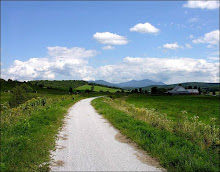
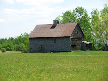
Let’s explore the Pine Barrens in Madison. This area is New Hampshire’s last intact example of a pitch pine/scrub oak woodland, a globally rare forest type. The main trails are wide, firm(if a bit sandy) and flat. There will be a couple of trail segments that are more like simple single track than the main wide trails. There may be a section of the West Branch Trail that is wet so expect a bit of mud and a walk through this area. We haven't ridden here for several years so that will give us the opportunity to rediscover and explore this area anew.
Directions: Take Route 16 south of Conway to the intersection of Route 113 at Coleman’s. Take a left and follow 113 through Madison. After you see Silver Lake on your left, Route 41 will diverge to the left. Follow Route 41 for 3.4 miles along the western side of the lake. The Nature Conservancy entrance and sign will be on the left directly opposite Black Birch Road. Drive in to the kiosk and parking area.
Or take Route 16 south to the junction of Route 16 and Route 41 in Ossipee, follow Route 41 north for approximately 2 miles, crossing into the Town of Madison. The entrance to the preserve will be on the right side of the road, marked by a TNC sign.
Let's meet at the Scenic Vista at 9:30 and start the ride around 10:15. Please contact me before 8am if you plan to ride.
Monday, October 14, 2013

Monday, October 7, 2013
Wild River Ride
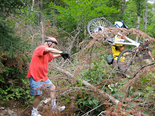
It's been two years since Irene ripped through the White Mountains and the Wild River lived up to it's name. One of the suspension bridges across the river was completely blown out, the other survived although it also was damaged. The dirt Wild River Road was washed out in many places and the campground was not there anymore. The Wild River Trail which went from the campground into the Wilderness Area was underminded and gouged out on the way to a gargantuan mass of trees and other debris which created an impenetrable wall that cut off the trail.
This Tuesday, let's revisit the beautiful Wild River Valley and see what remains of Irene's impact. The destoyed suspension bridge has been replaced, the road has been rebuilt and the campground is back in action, but I bet that staggering mountain of trees and debris is still there. Check out the Forest Service's website which has before and after photos of Wild River Road.
http://www.fs.usda.gov/Internet/FSE_DOCUMENTS/stelprdb5382177.pdf
From the ride's starting point on Route 2 just before the intersection of Route 113 we'll ride about 3 miles up to Wild River Road. We may encounter a few cars on Route 113, but weekday traffic should be light. As we bike the almost 6 miles to the campground we’ll still get a sense of the force of the flood waters and the large scale repairs that have been made. In all we’ll cover something like 18 miles on this out and back ride. This ride generally follows the old Wild River Railroad route into this area. So the riding is pretty easy although it isn't flat and there are some hills. As we go into the valley the road rises gradually and the return is a very fun downward ride.
Directions: Go to Gorham on route 16 north. At the Route 2 intersection go right toward Maine. About 2 (I think it’s 1.9) miles beyond the Maine State line take a right onto a dirt road which leads to the site of the old bridge and a large parking area. If you get to the new bridge which is just beyond our turn off you’ve gone too far. And if you get to Route 113, on the right, just over the new bridge you’ll know you’ve over shot the starting point.
Let’s start the ride at 10:00am. It’s forecasted to be a beautiful day and we can have a picnic lunch along the river. If anyone wants to carpool meet at the Jackson Old Town Hall parking lot across from the post office at 9:10am. Don't forget to bring your lunch and some water. Please contact me before 8am tomorrow if you plan to ride.
This Tuesday, let's revisit the beautiful Wild River Valley and see what remains of Irene's impact. The destoyed suspension bridge has been replaced, the road has been rebuilt and the campground is back in action, but I bet that staggering mountain of trees and debris is still there. Check out the Forest Service's website which has before and after photos of Wild River Road.
http://www.fs.usda.gov/Internet/FSE_DOCUMENTS/stelprdb5382177.pdf
From the ride's starting point on Route 2 just before the intersection of Route 113 we'll ride about 3 miles up to Wild River Road. We may encounter a few cars on Route 113, but weekday traffic should be light. As we bike the almost 6 miles to the campground we’ll still get a sense of the force of the flood waters and the large scale repairs that have been made. In all we’ll cover something like 18 miles on this out and back ride. This ride generally follows the old Wild River Railroad route into this area. So the riding is pretty easy although it isn't flat and there are some hills. As we go into the valley the road rises gradually and the return is a very fun downward ride.
Directions: Go to Gorham on route 16 north. At the Route 2 intersection go right toward Maine. About 2 (I think it’s 1.9) miles beyond the Maine State line take a right onto a dirt road which leads to the site of the old bridge and a large parking area. If you get to the new bridge which is just beyond our turn off you’ve gone too far. And if you get to Route 113, on the right, just over the new bridge you’ll know you’ve over shot the starting point.
Let’s start the ride at 10:00am. It’s forecasted to be a beautiful day and we can have a picnic lunch along the river. If anyone wants to carpool meet at the Jackson Old Town Hall parking lot across from the post office at 9:10am. Don't forget to bring your lunch and some water. Please contact me before 8am tomorrow if you plan to ride.
Monday, September 30, 2013
Stone House Loops - Evans Notch
This is one of our top three rides it is sooo... beautiful. Every year the foliage is magnificent and the scenery is spectacular! Don't miss this ride!!!
This route first loops around Deer Hill on; route 113, Stone House Road, Shell Pond Trail, a bit of Shell Pond Loop Trail and Deer Hill Road. Most of the loop will be on dirt roads or trails. There will be one trail segment that is a bit rough but doable (and quite walkable for those who choose to) especially where we will link up to Deer Hill Road from the Shell Pond area. Then we'll make another loop as we head up to the Bricket Place and on to The Basin for a lunch amid the eye popping scenery. And then it's back to our cars via route 113.
We’ll start the ride at the Forest Service parking lot which is about .10 mi north of the AMC Cold River Camp entrances on the right side of route 113. Meet for car pooling at the Scenic Vista parking lot in North Conway, at 9:00. We should be ready to start the ride at about 10:00am.
Please contact me if you plan to join in the ride.
This route first loops around Deer Hill on; route 113, Stone House Road, Shell Pond Trail, a bit of Shell Pond Loop Trail and Deer Hill Road. Most of the loop will be on dirt roads or trails. There will be one trail segment that is a bit rough but doable (and quite walkable for those who choose to) especially where we will link up to Deer Hill Road from the Shell Pond area. Then we'll make another loop as we head up to the Bricket Place and on to The Basin for a lunch amid the eye popping scenery. And then it's back to our cars via route 113.
We’ll start the ride at the Forest Service parking lot which is about .10 mi north of the AMC Cold River Camp entrances on the right side of route 113. Meet for car pooling at the Scenic Vista parking lot in North Conway, at 9:00. We should be ready to start the ride at about 10:00am.
Please contact me if you plan to join in the ride.
Monday, September 23, 2013
Gorham to Randolph on the Rail Trail
Let's check out the colors north of the Notch it should be a beautiful day and a beautiful ride! Please contact me if you plan to ride tomorrow.
This trail, on the old B&M rail bed, will take us through lovely woods with beaver ponds and meadows and some beautiful mountain views. From the Route 2 trail head we'll ride the old rail bed to the intersection of Pinkham B Road. Then we'll switch to Durand Road and take that to the rail trail's height of land at the Castle Trail in Bowman (Randolph). The ride back from Bowman on the rail trail is a blast as it is ever so slightly downhill. In all we'll cover about 20 miles. The surface of the trail is mostly dirt with some ballast and an occasional sandy spot.
Directions: Go north on Route 16 to Gorham. When route 16 meets route 2 at the T intersection turn left. Go through Gorham on Routes 16 and 2 until Route 2 diverges to the left at the traffic light . You'll see the trail head parking lot on the right about .8 mile after you turn left on Route 2.
Carpooling: Meet at the Old Jackson Town Hall at 9:20. We should start the ride in Gorham by 10:00am.
For those who are interested in amazingly good panninis, we can go to Saladino's in downtown Gorham for lunch after the ride.
This trail, on the old B&M rail bed, will take us through lovely woods with beaver ponds and meadows and some beautiful mountain views. From the Route 2 trail head we'll ride the old rail bed to the intersection of Pinkham B Road. Then we'll switch to Durand Road and take that to the rail trail's height of land at the Castle Trail in Bowman (Randolph). The ride back from Bowman on the rail trail is a blast as it is ever so slightly downhill. In all we'll cover about 20 miles. The surface of the trail is mostly dirt with some ballast and an occasional sandy spot.
Directions: Go north on Route 16 to Gorham. When route 16 meets route 2 at the T intersection turn left. Go through Gorham on Routes 16 and 2 until Route 2 diverges to the left at the traffic light . You'll see the trail head parking lot on the right about .8 mile after you turn left on Route 2.
Carpooling: Meet at the Old Jackson Town Hall at 9:20. We should start the ride in Gorham by 10:00am.
For those who are interested in amazingly good panninis, we can go to Saladino's in downtown Gorham for lunch after the ride.
Monday, September 16, 2013
September 17th
It looks like nearly all of the group is off having adventures elsewhere. If you'd like to go for a ride please contact me.
Monday, September 9, 2013
Monday, September 2, 2013
Gorham to Randolph on Rail Trail
The fog is lifting and the forecasts call for partly cloudy conditions this morning. So LET'S RIDE!
Oh Boy! Trying to figure out tomorrow's weather is nearly impossible. So let's be optimistic and plan for a rideable day on the eastern end of the gentle and very scenic Presidential Rail Trail. Check back tomorrow morning around 8am for an update. Please let me know if you plan to meet the group in Gorham and not at the carpool spot.
This trail, on the old B&M rail bed, will take us through lovely woods with beaver ponds and meadows and some beautiful mountain views. From the Route 2 trail head we'll ride the old rail bed to the intersection of Pinkham B Road. Then we'll switch to Durand Road and take that to the rail trail's height of land at the Castle Trail in Bowman (Randolph). The ride back from Bowman on the rail trail is a blast as it is ever so slightly downhill. In all we'll cover about 20 miles. The surface of the trail is mostly dirt with some ballast and an occasional sandy spot.
Directions: Go north on Route 16 to Gorham. When route 16 meets route 2 at the T intersection turn left. Go through Gorham on Routes 16 and 2 until Route 2 diverges to the left at the traffic light . You'll see the trail head parking lot on the right about .8 mile after you turn left on Route 2.
Carpooling: Meet at the Old Jackson Town Hall at 9:20. We should start the ride in Gorham by 10:00am.
Bring sunscreen (?), plenty of water and a snack (or lunch). For those who are interested in amazingly good panninis, we can go to Saladino's in downtown Gorham for lunch after the ride.
Subscribe to:
Posts (Atom)