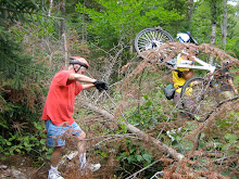
It's been almost a year since Irene ripped through the White Mountains and the Wild River lived up to it's name. Last year we viewed the awesome changes that resulted from the deluge in the Wild River Valley. One of the suspension bridges across the river was completely blown out, the other survived although it also was damaged. The dirt Wild River Road was washed out in many places and the campground was not there anymore. The Wild River Trail which went from the campground into the Wilderness Area was underminded and gouged out on the way to a gargantuan mass of trees and other debris which created an impenetrable wall that cut off the trail.
This Tuesday August 21st, let's revisit the beautiful Wild River Valley and see what The Forest Service and it's contractors have been up to in the last 51 weeks. The road has been rebuilt and the campground is back in action, but I bet that staggering mountain of trees and debris is still there. Check out the Forest Service's website which has before and after photos of Wild River Road.
http://www.fs.usda.gov/Internet/FSE_DOCUMENTS/stelprdb5382177.pdf
From the ride's starting point on Route 2 just before the intersection of Route 113 we'll ride about 3 miles up to Wild River Road. We may encounter a few cars on Route 113, but weekday traffic should be light. As we bike the almost 6 miles to the campground we’ll still get a sense of the force of the flood waters and the large scale repairs that have been made. In all we’ll cover something like 18 miles on this out and back ride. This ride generally follows the old Wild River Railroad route into this area. So the riding is pretty easy although it isn't flat and there are some hills. As we go into the valley the road rises gradually and the return is a very fun downward ride.
Directions: Go to Gorham on route 16 north. At the Route 2 intersection go right toward Maine. About 2 (I think it’s 1.9) miles beyond the Maine State line take a right onto a dirt road which leads to the site of the old bridge and a large parking area. If you get to the new bridge which is just beyond our turn off you’ve gone too far. And if you get to Route 113, on the right, just over the new bridge you’ll know you’ve over shot the starting point.
Let’s start the ride at 10:00am. It’s going to be a beautiful day and we can have a picnic lunch along the river. If anyone wants to carpool meet at the Jackson Old Town Hall parking lot across from the post office at 9am. Don't forget to bring your lunch and some water.
Monday, August 20, 2012

Monday, August 13, 2012
Gorge(ous) Lovell
It’s the height of the tourist season. Has anyone else noticed the epic backups going into and out of North Conway? So tomorrow, August 14th, we need to get far from the madding crowds. And there’s nowhere more remote and scenic as the Kezar Falls Gorge /Five Kezar Ponds area out of Lovell, Maine. You’ll be surprised at the remoteness of the second half of the ride.
We'll start out at the Lovell Historical Society and take Old Waterford Road to Kezar Falls Gorge, which Delorme rightly describes as a unique natural area. Then the route will take us to the Five Kezar Ponds where we’ll take a path around one. Next we’ll retrace our tracks back down Old Waterford Road to a dirt road and head out to the Dan Charles Pond area and then after a series of dirt roads (with a couple of sandy spots) we’ll come out on Fern St which will lead us back to Old Waterford Road and the Historical Society. After the heavy rains on Friday we may encounter puddles etc.
There are a few hills, primarily at the beginning of the ride so we’ll get our most aerobic exercise during the cooler part of the day. Otherwise the terrain will be relatively easy to cover. The surface will be pavement, pavement reverting to dirt, dirt and packed sandy soil. We should cover a bit over 19 miles. Bring lunch, water and sunscreen.
Added Bonus: The Historical Society will be open Tuesday so you can nip in there for a look see at the exhibits after the ride.
Please be ready to ride at 9:30am. Park in the lot/field which is on the left, just across from the historical society building which is 1.5 miles past the intersection of routes 93 and 5 in Lovell. To get to Lovell take route 5 north out of Fryeburg, Me.
Carpooling: Meet at the Scenic Overlook in North Conway which is conveniently located across the street from Trails End Ice Cream Shop. Meet Time 8:40am
We'll start out at the Lovell Historical Society and take Old Waterford Road to Kezar Falls Gorge, which Delorme rightly describes as a unique natural area. Then the route will take us to the Five Kezar Ponds where we’ll take a path around one. Next we’ll retrace our tracks back down Old Waterford Road to a dirt road and head out to the Dan Charles Pond area and then after a series of dirt roads (with a couple of sandy spots) we’ll come out on Fern St which will lead us back to Old Waterford Road and the Historical Society. After the heavy rains on Friday we may encounter puddles etc.
There are a few hills, primarily at the beginning of the ride so we’ll get our most aerobic exercise during the cooler part of the day. Otherwise the terrain will be relatively easy to cover. The surface will be pavement, pavement reverting to dirt, dirt and packed sandy soil. We should cover a bit over 19 miles. Bring lunch, water and sunscreen.
Added Bonus: The Historical Society will be open Tuesday so you can nip in there for a look see at the exhibits after the ride.
Please be ready to ride at 9:30am. Park in the lot/field which is on the left, just across from the historical society building which is 1.5 miles past the intersection of routes 93 and 5 in Lovell. To get to Lovell take route 5 north out of Fryeburg, Me.
Carpooling: Meet at the Scenic Overlook in North Conway which is conveniently located across the street from Trails End Ice Cream Shop. Meet Time 8:40am
Monday, August 6, 2012
Ammonoosuc Rail Trail
Last year we didn’t get to this ride which is a shame since it is goes
through such beautiful countryside. It
is a multi-use rail trail that runs about 20 miles between Woodsville and
Littleton along the Ammonoosuc River. Tomorrow we'll ride the northern half of
the trail from Littleton to Lisbon for about 20 miles out and back, on this
almost flat route which wends its way through bucolic woods and farm lands by
the Ammonoosuc River. If you are so
inclined, you can cool off in the Ammonoosuc after the ride at the very scenic
swimming hole next to the lot where we’ll park our cars. Bring a towel and a change of clothes.
Littleton is a neat little town. After we ride we can visit Bishops Homemade Ice Cream Shop. Yankee Magazine rated it one of the top five ice cream stands in New England. Need I say more? Also there's Chuttters which boasts the "world’s longest candy counter". Even if you’re not a big candy fan it is quite a sight and worth a visit. Other historic points of interest include Thayers Inn which was built in 1850. Common areas and a couple of rooms are open for viewing. Five Presidents and countless celebrities and national politicians have been guests at Thayers Inn. And there's the Littleton Grist Mill which is a restored 1798 mill and museum. All of these attractions are in the bustling downtown area and are a short walk from our cars which will be parked behind the Littleton Bike shop in their parking lot.
Bring: plenty of water, sunscreen, and lunch
Carpooling: Meet at 8:45am in the Attitash parking lot at the very west end far away from where the Attitash summer patrons usually park their cars. We will start the ride by 10:00am. Please let me know if you plan to meet the group in Littleton, so that we don’t start without you.
Directions: Take route 302 northwest to Bethlehem and get on route 93 northbound. At exit 41 head north on route 302 towards downtown Littleton. In about ¾ of a mile The Littleton Bike Shop will be on the left. It is 23 Cottage Street (route 302). Take the driveway/road just before the bike shop building and park in back.
Littleton is a neat little town. After we ride we can visit Bishops Homemade Ice Cream Shop. Yankee Magazine rated it one of the top five ice cream stands in New England. Need I say more? Also there's Chuttters which boasts the "world’s longest candy counter". Even if you’re not a big candy fan it is quite a sight and worth a visit. Other historic points of interest include Thayers Inn which was built in 1850. Common areas and a couple of rooms are open for viewing. Five Presidents and countless celebrities and national politicians have been guests at Thayers Inn. And there's the Littleton Grist Mill which is a restored 1798 mill and museum. All of these attractions are in the bustling downtown area and are a short walk from our cars which will be parked behind the Littleton Bike shop in their parking lot.
Bring: plenty of water, sunscreen, and lunch
Carpooling: Meet at 8:45am in the Attitash parking lot at the very west end far away from where the Attitash summer patrons usually park their cars. We will start the ride by 10:00am. Please let me know if you plan to meet the group in Littleton, so that we don’t start without you.
Directions: Take route 302 northwest to Bethlehem and get on route 93 northbound. At exit 41 head north on route 302 towards downtown Littleton. In about ¾ of a mile The Littleton Bike Shop will be on the left. It is 23 Cottage Street (route 302). Take the driveway/road just before the bike shop building and park in back.
Sunday, July 29, 2012
Experimental Forest and Reservoir Brook Trail
This Tuesday Barbara has invited us back to her house after the ride for
refreshments and a dip in her pool for those who are so inclined. To keep the driving and logistics to a minimum
let’s do a local ride - The Experimental Forest and Reservoir Brook Trail
ride.
We'll start off at the top of Bear Notch Road and cruise down the dirt roads in the Bartlett Experimental Forest. Then we'll cross over to the east side of Bear Notch Road and do some fun single track and old logging roads on the Reservoir Brook Trail.
In all we’ll cover less than 10 miles. For those of you who want to add to your mileage you could meet us at the top of Bear Notch between 10:15 and 10:30. Or you could pedal to Barbara’s after the ride. Or you could add some miles by biking on River Road before the ride.
Let's meet at 10:00am, in the parking lot off River Road just after it crosses the Saco River in Bartlett.
Directions: Take Route 302 to Bartlett, at the blinking light in the center of Bartlett take a right and in about half a mile you'll cross the Saco River and the parking area will be to the left of the bridge.
Bring your lunch to eat at Barbara’s. Also pack water, sunscreen and bug spray.
We will need to shuttle people and bikes up to the top entrance of the Experimental Forest (which is almost at the top of Bear Notch) from the parking area. Then we'll start our mostly downhill adventure.
We'll start off at the top of Bear Notch Road and cruise down the dirt roads in the Bartlett Experimental Forest. Then we'll cross over to the east side of Bear Notch Road and do some fun single track and old logging roads on the Reservoir Brook Trail.
In all we’ll cover less than 10 miles. For those of you who want to add to your mileage you could meet us at the top of Bear Notch between 10:15 and 10:30. Or you could pedal to Barbara’s after the ride. Or you could add some miles by biking on River Road before the ride.
Let's meet at 10:00am, in the parking lot off River Road just after it crosses the Saco River in Bartlett.
Directions: Take Route 302 to Bartlett, at the blinking light in the center of Bartlett take a right and in about half a mile you'll cross the Saco River and the parking area will be to the left of the bridge.
Bring your lunch to eat at Barbara’s. Also pack water, sunscreen and bug spray.
We will need to shuttle people and bikes up to the top entrance of the Experimental Forest (which is almost at the top of Bear Notch) from the parking area. Then we'll start our mostly downhill adventure.
Monday, July 23, 2012
Dam, Dam, Dam, Dam and Hot Dam!
This favorite route, runs from the Gorham train depot to the Berlin eastern depot. It has a
lot of variety, not to mention about five dams. We'll start off in downtown
Gorham by the old
train station and ride past the airport and then ride a mile through the backs
woods on the emergency access road which is closed to motorized traffic. After
this we will be riding on the eastern end of the presidential rail trail to
Berlin on the quiet and beautiful eastern bank of the Androscoggin River.
Along with getting great views of the Androscoggin we'll skirt a gravel pit, go over the very high trestle bridge across route 16 (this is always a thrill), bike by the hydroelectric powerhouse and dam on the canal adjacent to the Androscoggin, view the Cascade Flats complex and dam from the seldom seen east side and visit a waterfall, for a lunch stop. This is probably the most beautiful fat tire cruiser lunch spot.
The changing surface of this pretty flat ride consists of dirt, ballast, gravel and the occasional mud puddle. This 17 mile out and back route is appropriate for all abilities. The ride will start at 10:00 on Railroad Street across from the Gorham Town Common.
Please Note: Check back here tomorrow morning around 8am if the weather looks iffy.
Carpooling: Meet at the Jackson Historical Society aka the Old Jackson Town Hall, parking lot (across from the post office) at 9:20.
Directions: Drive north on route 16 to Gorham. Just before the T intersection with route 2 there will be railroad tracks. Immediately after crossing the tracks turn left onto Railroad Street. Hook a U turn and park on the other side of the road across from the Common.
To view a map of this ride click below.
http://www.mapmyride.com/routes/view/20611220
Along with getting great views of the Androscoggin we'll skirt a gravel pit, go over the very high trestle bridge across route 16 (this is always a thrill), bike by the hydroelectric powerhouse and dam on the canal adjacent to the Androscoggin, view the Cascade Flats complex and dam from the seldom seen east side and visit a waterfall, for a lunch stop. This is probably the most beautiful fat tire cruiser lunch spot.
The changing surface of this pretty flat ride consists of dirt, ballast, gravel and the occasional mud puddle. This 17 mile out and back route is appropriate for all abilities. The ride will start at 10:00 on Railroad Street across from the Gorham Town Common.
Please Note: Check back here tomorrow morning around 8am if the weather looks iffy.
Carpooling: Meet at the Jackson Historical Society aka the Old Jackson Town Hall, parking lot (across from the post office) at 9:20.
Directions: Drive north on route 16 to Gorham. Just before the T intersection with route 2 there will be railroad tracks. Immediately after crossing the tracks turn left onto Railroad Street. Hook a U turn and park on the other side of the road across from the Common.
To view a map of this ride click below.
http://www.mapmyride.com/routes/view/20611220
Sunday, July 15, 2012
Echo Lake and Moat Mountain Loop
It’s
the middle of summer and Tuesday’s forecast is for a hot and muggy day. So what do you say we do a mellow ride with
plenty of shade? The Echo Lake and Moat
Mountain loop fits this bill nicely.
The
starting point will be the parking lot just outside Echo Lake State Park in North
Conway. From there we'll ride south on
West Side Road for about 3 miles and then enter The National Forest on a trail
in the Cedar Creek Development. As an
added feature, we’ll see the new signs which mark the trail heads and junctions
of the Moat Mountain biking system.
These were installed recently by our very own White Mountain NEMBA
Chapter in cooperation with The Forest Service.
After entering the Moat Mountain area we’ll take the old rail trail to the top of the quarry for some great views. After retracing our way back to Forest Road 379A we’ll head in the general direction of Echo Lake.
After entering the Moat Mountain area we’ll take the old rail trail to the top of the quarry for some great views. After retracing our way back to Forest Road 379A we’ll head in the general direction of Echo Lake.
Most
of this ride is pretty flat and suitable for all abilities. So for those of you
who are fairly new to fat tire riding this would be a great ride. We will cover
about 4 miles of pavement and 6-8 miles of dirt forest trails.
Meet at 9:00am in the parking lot just outside and to the left of the gates to Echo Lake State Park in North Conway. Bring bug spray, a snack or lunch and sun screen. See you there.
Meet at 9:00am in the parking lot just outside and to the left of the gates to Echo Lake State Park in North Conway. Bring bug spray, a snack or lunch and sun screen. See you there.
Sunday, July 8, 2012
Presidential Rail Trail - Gorham Side
It looks like Tuesday July 10th is going to be a wonderful day for a ride. So it'll be a great day to ride the eastern end of the gentle and very scenic Presidential Rail Trail.
This easy trail, on the old B&M rail bed, will take us through lovely woods with beaver ponds and meadows and some beautiful mountain views. From the Route 2 trail head we'll ride the old rail bed to the intersection of Pinkham B Road. Then we'll switch to Durand Road and take that to the rail trail's height of land at the Castle Trail in Bowman (Randolph). The return journey will be wholly on the rail trail.
The ride back to our starting point will be a breeze as it is ever so slightly downhill. In all we'll cover about 20 miles. The surface of the trail is mostly dirt with some ballast and an occasional sandy spot. We usually ride this trail earlier in the season as it is a good "starter trail". But we had all rainy Tuesdays in May.
Directions: Go north on Route 16 to Gorham. When route 16 meets route 2 at the T intersection turn left. Go through Gorham on Routes 16 and 2 until Route 2 diverges to the left at the traffic light . You'll see the trail head parking lot on the right about .8 mile after you turn left on Route 2.
Carpooling: Meet at the Old Jackson Town Hall at 9:15. We should start the ride in Gorham by 10:00am.
Bring sunscreen, plenty of water and a snack (or lunch). For those who are interested in amazingly good panninis, we can go to Saladino's in downtown Gorham for lunch after the ride.
This easy trail, on the old B&M rail bed, will take us through lovely woods with beaver ponds and meadows and some beautiful mountain views. From the Route 2 trail head we'll ride the old rail bed to the intersection of Pinkham B Road. Then we'll switch to Durand Road and take that to the rail trail's height of land at the Castle Trail in Bowman (Randolph). The return journey will be wholly on the rail trail.
The ride back to our starting point will be a breeze as it is ever so slightly downhill. In all we'll cover about 20 miles. The surface of the trail is mostly dirt with some ballast and an occasional sandy spot. We usually ride this trail earlier in the season as it is a good "starter trail". But we had all rainy Tuesdays in May.
Directions: Go north on Route 16 to Gorham. When route 16 meets route 2 at the T intersection turn left. Go through Gorham on Routes 16 and 2 until Route 2 diverges to the left at the traffic light . You'll see the trail head parking lot on the right about .8 mile after you turn left on Route 2.
Carpooling: Meet at the Old Jackson Town Hall at 9:15. We should start the ride in Gorham by 10:00am.
Bring sunscreen, plenty of water and a snack (or lunch). For those who are interested in amazingly good panninis, we can go to Saladino's in downtown Gorham for lunch after the ride.
Subscribe to:
Posts (Atom)