Monday, July 28, 2014

Ammonoosuc Rail Trail

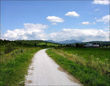
Last year I don't think we got to this ride which is a shame since it is goes through such beautiful countryside.  This is a well drained trail which we will need after today's rain finishes.  It is a multi-use rail trail that runs about 20 miles between Woodsville and Littleton along the Ammonoosuc River. Tomorrow we'll ride the northern half of the trail from Littleton  for up to 20 miles out and back, on this almost flat route which wends its way through bucolic woods and farm lands by the Ammonoosuc River.  If you are so inclined, you can cool off in the Ammonoosuc after the ride at the very scenic swimming hole next to the lot where we’ll park our cars.

Littleton is a neat little town. After we ride we can visit Bishops Homemade Ice Cream Shop. Yankee Magazine rated it one of the top five ice cream stands in New England. Need I say more? Also there's Chuttters which boasts the "world’s longest candy counter". Even if you’re not a big candy fan it is quite a sight and worth a visit. Other historic points of interest include Thayers Inn which was built in 1850.

Bring: plenty of water, sunscreen, and lunch.

Carpooling:  Meet at 9:00am in the Attitash parking lot at the very west end far away from where the Attitash summer patrons usually park their cars.  We will start the ride by 10:00am.  Please let me know if you plan to ride and where you plan to meet the group so that we don’t start without you.

Directions: Take route 302 northwest to Bethlehem and get on route 93 northbound. At exit 41 head north on route 302 towards downtown Littleton. In about ¾ of a mile The Littleton Bike Shop will be on the left. It is 23 Cottage Street (route 302). Take the driveway/road just before the bike shop building and park in back.

Monday, July 21, 2014

Presidential Range Rail Trail

GORHAM TO RANDOLPH

It's going to be sunny and hot tomorrow so a gentle trail with shade would be a good fit.  The Presidential rail trail will be mostly downhill for the second half of the ride and that's when it will be hottest.

This gentle rail trail, on the old B&M rail bed, follows the Moose River through lovely woods with beaver ponds and meadows and some beautiful mountain views. From the Route 2 trail head we'll ride the old rail bed to the intersection of Pinkham B Road. Then we'll switch to Durand Road and take that to the rail trail's height of land at the Castle Trail in Bowman (Randolph).  The ride back from Bowman on the rail trail is a blast as it is ever so slightly downhill. In all we'll cover about 20 miles. The surface of the trail is mostly dirt with some ballast and an occasional sandy spot.

Directions: Go north on Route 16 to Gorham. When route 16 meets route 2 at the T intersection turn left. Go through Gorham on Routes 16 and 2 until Route 2 diverges to the left at the traffic light . You'll see the trail head parking lot on the right about .8 mile after you turn left on Route 2.


Carpooling: Meet at the Old Jackson Town Hall at 8:20. We should start the ride in Gorham by 9:00am to take advantage of the cooler morning air.  

Bring sunscreen (?), plenty of water and a snack (or lunch).  Please contact me Monday if you plan to ride so that we don't start the ride without you.  Thanks.

Monday, July 7, 2014

Gorgeous Lovell

It’s the height of the tourist season. Has anyone else noticed the epic backups going into and out of North Conway? So tomorrow we need to get far from the madding crowds. And there’s nowhere more remote and scenic as the Kezar Falls Gorge /Five Kezar Ponds area out of Lovell, Maine. You’ll be surprised at the remoteness of the second half of the ride.

We'll start out at the Lovell Historical Society and take Old Waterford Road to Kezar Falls Gorge, which Delorme rightly describes as a unique natural area. Then the route will take us to the Five Kezar Ponds where we’ll take a path around one. Next we’ll retrace our tracks back down Old Waterford Road to a dirt road and head out to the Dan Charles Pond area and then after a series of dirt roads (with a couple of sandy spots) we’ll come out on Fern St which will lead us back to Old Waterford Road and the Historical Society. 

There are a few hills, primarily at the beginning of the ride so we’ll get our most aerobic exercise during the cooler part of the day. Otherwise the terrain will be relatively easy to cover. The surface will be pavement, pavement reverting to dirt, dirt and packed sandy soil. We should cover a bit over 19 miles.  Bring lunch, water and sunscreen.

Added Bonus: The Historical Society will be open Tuesday so you can nip in there for a look see at the exhibits after the ride.

Please let me know if you plan to ride tomorrow in case the ride plan changes.

Be ready to ride at 9:30am. Park in the lot/field which is on the left, just across from the historical society building which is 1.5 miles past the intersection of routes 93 and 5 in Lovell. To get to Lovell take route 5 north out of Fryeburg, Me.

Carpooling: Meet at the Scenic Overlook in North Conway which is conveniently located across the street from Trails End Ice Cream Shop. Meet Time 8:30am

Monday, June 30, 2014

Believe in Books

Bob will be leading the group this week and he has outlined it below.  Have fun!

BELIEVE IN BOOKS INTERMEDIATE LOOP

Start at Whitaker Woods
Ride goes down the power lines, toward the police station.
The rec path along the Saco
Past Davis Park
Up Pasaconway Road
High Street to the forest Road to Hales
Roads back to the beginning

Total about 20 miles, some single track, a hill or 2

Meet at Whitaker Woods at 930

Monday, June 23, 2014

Dam and Dummer

This fabulous ride starts across the street from the Berlin Airport. First we'll pedal north on the rural and quiet East Side River Road which closely follows the Androscoggin River and has wonderful views. Next we'll turn right onto Hill Street, a dirt road which gently rises through woods and farm lands and takes us on a loop with great southern views.  Then we rejoin East Side River Road. From here we'll ride to dirt roads which parallel a hydropower canal before getting us to the seldom visited east side of the Androscoggin River. Before starting our return on East Side River Road we'll stop for a water front lunch at either the dam or the hydro station south of the dam.

To see the map of this 18 mile part paved country road and part dirt road ride click here: http://www.mapmyride.com/routes/view/17313468.

Driving directions:Take route 16 north through Berlin. About 3 miles past the Nansen Wayside Park (old ski jump on the left and waterfront park on right), Bridge Street will be on the right. You should also see an airport sign pointing right too. Cross over the Androscoggin River and at the end of Bridge Street pull into the ball park lot on your left.

There is, at this time, a slight chance of rain.  So, let's all meet up at the Jackson Historical Society parking lot which is across the street from the Post Office at 9:00am in case we need to change the ride plan.  Also please let me know if you plan to ride tomorrow.  See you tomorrow.

Monday, June 16, 2014

Pondicherry - The Wildflower Tour

The weather tomorrow looks good and the lupines and other wild flowers are in full bloom.  So now is the time to visit the gorgeous Pondicherry area.

We’ll start at the western terminus of The Presidential Range Rail Trail and pedal through almost four miles of The Pondicherry National Wildlife Refuge where the views are absolutely magnificent. Then we’ll head for more open vistas on three miles of paved country road and another three plus miles on the dirt Valley Road. When we reach Jefferson Notch Road we will return to Pondicherry on The Rail Trail. In all we’ll cover about 18 miles with breath taking  mountain views and the panoply of wild flower filled fields.

The rail trail has a pretty firm surface and is a combination of dirt, gravel, stone, cinder and ballast. This is a relatively flat route with no major hills. It’s just a wonderful cruise through a beautiful area.

Directions: Take route 302 through Bretton Woods and at the traffic light go right on route 3 for 1.9 miles. Then take another right on route 115. In 4.4 miles Hazen Road will be on your left, take it. In another 1.4 miles you will see a sign on the right that says Trail Parking. Go right into the small parking lot. We may have to do some creative parking to fit us all in here.

Carpooling is a must due to the small parking lot at Pondicherry. Meet at 9:00am at the far west end of the Attitash parking lot.

Please note: I won't be riding with you tomorrow so here's a more detailed description of the route.

From the parking lot take the dirt road at the north end for about 1.5 miles. As you approach Cherry Pond the rail trail will diverge to your right.  Take this past the pond and marshes until you reach route 115a.  Go left and when you reach Israel River Road in 0.6 mile go right.  In a few miles cross route 115 onto Valley Road.  In another few miles you will reach Jefferson Notch Road.  Turn right and almost immediately you will turn right again onto the presidential rail trail.  This will take you back to Pondicherry.  Here you can have lunch on the viewing platform at the pond.  Please make sure you meet up with the group at Attitash to confirm the ride plan.


Click here for a map of this ride.
http://www.mapmyride.com/routes/view/11313897

Monday, June 9, 2014

Echo Lake and Moat Mountain Loop


 CANCELED -  It's raining now and the radar shows that more is headed our way.

It appears that the weather will be unsettled tomorrow.  Can we get a ride in?  We'll lets try and see what it looks like in the morning.  So a local ride and one where we are not far from our cars would be best.

The Echo Lake and Moat Mountain loop fits this bill nicely.  


The starting point is the parking lot just outside Echo Lake State Park in North Conway.  From there we'll ride south on West Side Road for about 3 miles and then enter The National Forest on a trail in the Cedar Creek Development.  After entering the Moat Mountain area we’ll take the old rail trail to the top of the quarry for some great views.  After retracing our way back to Forest Road 379A we’ll head in the general direction of Echo Lake.
Most of this ride is pretty flat and suitable for all abilities. So for those of you who are fairly new to fat tire riding this would be a great ride. We will cover about 4 miles of pavement and a similar amount on easy dirt forest trails.

Meet at 9:30am in the parking lot just outside and to the left of the gates to Echo Lake State Park in North Conway. Bring bug spray, a snack or lunch.  Please let me know if you plan to ride by 8:00am. And check back around 8:15am to see if the ride is a go.