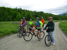
It looks like tomorrow will be 45 and sunny at the Pine Barrons in Madison. So how about one more ride? We'll meet at 11am at the kiosk in the Pine Barrons. Here's the description from the September 1st ride.
Let’s explore the Pine Barrens in Madison. This area is New Hampshire’s last intact example of a pitch pine/scrub oak woodland, a globally rare forest type. The main trails are wide, firm(if a bit sandy) and flat. There may be a section of the West Branch Trail that is wet due to the recent rains. So expect a bit of mud and a walk through this area. There will be a couple of trail segments that are more like simple single track than the main wide trails. We should cover about 10 miles in two hours or so. This ride is suitable for an experienced and confidant advanced novice. We’ll stop for lunch at Silver Lake.
Directions: Take Route 16 south of Conway to the intersection of Route 113 at Coleman’s. Take a left and follow 113 through Madison. After you see Silver Lake on your left, Route 41 will diverge to the left. Follow Route 41 for 3.4 miles along the western side of the lake. The Nature Conservancy entrance and sign will be on the left directly opposite Black Birch Road. Drive in to the kiosk and parking area.
Or take Route 16 south to the junction of Route 16 and Route 41 in Ossipee, follow Route 41 north for approximately 2 miles, crossing into the Town of Madison. The entrance to the preserve will be on the right side of the road, marked by a TNC sign.
Watch your email for an invitation to the End of Season Party December 13, at 5pm
Did you like the spoof below?
Tuesday, December 1, 2009
Friday, November 27, 2009
Another Ride Yikes!!!
How about one last ride? It will be a sunny December 1st and one for the record books! There are three rail trails in northern New Hampshire that we have not explored and they are in the same area. So why not do them all at once!!!
There is the 9.4 mile Warren Recreational Trail, which runs from Warren to Haverhill. Then we can take Bushwood Road to North Haverhill for 7.6 miles and hop on the 4.3 mile Blackmount spur line to Woodsville. The last section is the southern end of the Ammonoosuc Rail Trail for a 9.1 mile ride from Woodsville to Lisbon.
We’ll have to bundle up as the noontime forecasted temperature is 32 degrees. This will give us all the more reason to keep moving to stay warm and we do have over 30 miles to cover, assuming we spot some cars. Otherwise the out and back ride will be over 60 miles.
If we elect the out and back ride we will have the mother of all “walkable” hills for more than a mile on Bushwood Road. But heck this will only warm us up as the sun is setting. Did I mention that you should bring bike lights? If you don’t have one of these you can just duct tape a flashlight to your helmet!
The trail head is in the center of Warren where there is a missile which is standing upright and seemingly ready to launch. Meet you at the missile for blast off!
Questions? Comments? Click on the word "comments" just below this line.
Sunday, November 22, 2009
YIKES! Another ride?
Tuesday November 24, 2009
Is this our last ride of 2009? Maybe, so let’s do it up in style. Let’s bop on down to tony Wolfeboro for a ride on the Cotton Valley Rail Trail. After the ride we can explore the shops and points of interest in Wolfeboro, one of the original resort towns on Lake Winnipesauke.
The rail trail is crushed, packed stone and almost 7 miles long. In all we’ll peddle about 15 pretty easy miles on this loop route. From the trailhead at the restored train depot on Railroad Avenue, the crushed stone Russell C. Chase Bridge Falls Path leads to the rail trail proper. After the falls, the trail goes by a beaver pond with great views and bird watching and it also passes through some interesting tornado damage from 2008. Causeways that lead across Crescent Lake, then along Lake Wentworth are another stunning feature on this trail. At times you're surrounded by water on either side, and the views are nothing short of spectacular. And in a unique rail trail twist, sections of the trail actually run between the old rails, which are still in place and visible, though you cannot see the ties.
It ends at the intersection of Cotton Valley Road. Here we’ll go left (west) and return on Cotton Valley Road which becomes College Road. Both roads have gently rolling hills with the exception of one steep, but short hill on the way back. To get back to the rail trail and avoid the busy routes into Wolfeboro we’ll take a left on Westwood Drive to Tennis Court Lane which leads back to the rail trail and the center of Wolfeboro.
The Wolfeboro trailhead is at the restored train depot on Railroad Avenue, just west of the Route 109 and Route 28 intersection. Parking is available at the depot. Take route 16 south to route 28 (just before Ocean State Job Lot) in Ossipee. Go west about 9 miles on route 28 to Wolfeboro center. Then take a right on route 109 to Railroad Ave. Please be ready to start the ride at 11:00am.
Check this blog again on Tuesday morning if the weather forecast deteriorates.
Fat Tire Cruiser Party Sunday December 13 - Details to Follow
Saturday, November 14, 2009
Bob's Great Hill Loop
Ready for some back country roads in Tamworth? Well Bob has found a great 13-14 mile ride for us on mostly dirt roads in the back woods and farmland of northwestern Tamworth. This route is straight, curvy, flat, rolling, woodsy and open. Sounds like it has it all eh? The hills, for the most part are gentle, although there may be a couple that are "walkable". The fields surrounding the farms and summer "cottages" will give us magnificent views of the nearby scenery and mountains.
Going clockwise out of Tamworth center we'll ride on Cleveland Road to Brown Hill Road to Pease Hill Road to Great Hill Road to Hemenway Road, to 113A to Old Mail Road and back to our starting point on 113A. Don't be too concerned about the name Hill in most of these streets, it's not as serious as it sounds. Really.
We'll start the ride from lovely Tamworth center which is just west of the intersection of 113 and 113A. There is public parking behind the Town Offices building which is on the right. Please be ready to ride at 10:am.
Right now the weather forecast sounds great. But check back here on Monday night if it deteriorates. Also I haven't included a carpooling spot as we don't seem to need one on most days. See you there.
Sunday, November 8, 2009
DEER HILL LOOP
November 10, 2009
The weather forecast looks good for another ride. And Hurricane Mountain Road is still open. So let’s explore a new area in North Chatham NH. With all the summer traffic gone, we’ll have this beautiful spot almost all to ourselves, even route 113. When I was scouting there last week it was so tranquil and the views were magnificent especially on the section around Shell Pond.
We’ll loop around Deer Hill on route 113, Stone House Road, Shell Pond Trail, a bit of Shell Pond Loop Trail and Deer Hill Road. Most of the loop will be on dirt roads or trails. There will be one trail segment that is more walk able than ride able especially where we will link up to Deer Hill Road from the Shell Pond area. This 8 mile loop is pretty flat and easy to ride. And at the end of the ride we may choose to do some more exploring or ride up to The Basin which is about 2.5 - 3 miles from our starting point.
We’ll start the ride at the Forest Service parking lot (fee area) which is about .2mi north of the AMC Cold River Camp entrances on the right side of route 113. Meet for car pooling at the Scenic Vista parking lot in North Conway, at 9:30. We should be ready to start the ride at about 10:00am.
Sunday, November 1, 2009
Moat Mountain Romp
Tuesday November 3, 2009
Let's combine the forest roads with the single track in the Moat Mountain trail system, which is behind the Cedar Creek development. This is a wonderful area to ride in. There are red pine woods, beaver ponds with scenic views, hemlock glades and woodland streams. We'll have the opportunity to cruise Forest Roads 379 and 379A as well as Woods Road. There's plenty of single track to ride too including the Electric Loop and 100 Acre Woods. The roads are wide and flat and easy to ride. The single track requires a bit more skill. On these mostly flat and fun trails there will be the occasional rooty spot, dips and quick ascents, twists and turns and perhaps wet spots.
Let's combine the forest roads with the single track in the Moat Mountain trail system, which is behind the Cedar Creek development. This is a wonderful area to ride in. There are red pine woods, beaver ponds with scenic views, hemlock glades and woodland streams. We'll have the opportunity to cruise Forest Roads 379 and 379A as well as Woods Road. There's plenty of single track to ride too including the Electric Loop and 100 Acre Woods. The roads are wide and flat and easy to ride. The single track requires a bit more skill. On these mostly flat and fun trails there will be the occasional rooty spot, dips and quick ascents, twists and turns and perhaps wet spots.
Parking in this area is severely limited, so let's meet in North Conway at 9:30 am in the parking lot behind the Eastern Slopes Inn. The entrance to this lot is off River Road on the left, just past the railroad trestle, if you are driving from route 16. We'll double up on cars and head on over to Cedar Creek from there.
Sunday, October 25, 2009
Kezar Falls Gorge
October 27, 2009
Marianne has been working overtime. She's found a great ride for us in Lovell. There aren't enough O's in COOL to describe this ride.
We'll start out at the Lovell Historical Society and take Old Waterford Road to the Kezar Falls Gorge, an outstanding natural wonder. It will feel like the week of Halloween here as it is in the middle of nowhere. To loop back to our start we'll take ATV Trails through creepy hemlock forests and spooky scrub woods. You'll breath a sigh of relief to be away from the haunted and isolated back country, when you see familiar territory.
There are a few hills and you may want to walk up one or two. Otherwise the terrain will be relatively easy to cover. The surface will be pavement, dirt and packed, pretty firm, sandy soil. We should cover about 13 - 15 miles.
Please be ready to ride at 11:00am. Park in the lot which is on the left, just across from the historical society building 1.5 miles past the intesection of routes 93 and 5 in Lovell. To get to Lovell take route 5 north out of Fryeburg, Me. Please arrange your own carpooling.
Sunday, October 18, 2009
The Bretton Woods Triangle
Tuesday October 20th, 2009
This week we’ll have a really fun adventure in Bretton Woods. Several of you have said that you’d be interested in just exploring an area some Tuesday morning. Well this ride is for you. The area that lies inside the perimeter defined by Mt. Clinton Road, Cog Base Road and Route 302 in Bretton Woods has lots of ride able trails in the National Forest. When I was checking out the logistics for this ride, on Saturday, the views were magnificent. The Presidentials were most imposing and they have shed their summer coat and are now wearing winter white. Even though the temperature hovered around fifty, it was quite comfortable with warm pants and a fleece top over a turtleneck.
We’ll all be discovering this area together. I have a general plan for the ride that will get us started and we can improvise, at will, on this base route. The surface appeared to include wide woods paths, jeep trails and some double track. Expect to encounter surfaces that are dirt, grass covered and gravel and don’t forget rocks and roots and mud.
We’ll meet in the Attitash parking lot at 9:45 am for carpooling. The ride will start from the turn out for the Upper Ammonoosuc Falls on the Cog Base Road. It is a little more than 2.5 miles in from Route 302. There is a small bridge across the river here. If you don’t see a bridge across the river you are probably at the middle falls turn out and you need to travel a little further up the road towards the cog station. Please be ready to ride at 11:00am.
Bright clothing is recommended. It's that time of year.
Monday, October 12, 2009
Cancelled
October 13th Ride
It looks like we're in for a chilly and wet morning tomorrow. All the forecasts indicate that the temps will be in the mid to upper 30's in the morning and that it will rain and/or snow. SNOW!?! Let's wait for next week to ride again.
It looks like we're in for a chilly and wet morning tomorrow. All the forecasts indicate that the temps will be in the mid to upper 30's in the morning and that it will rain and/or snow. SNOW!?! Let's wait for next week to ride again.
Sunday, October 4, 2009
Don't Miss This Ride!!!
October 6, 2009
This is it the ride you have been waiting for, Pondicherry! We’ll start at the western terminus of The Presidential Range Rail Trail and pedal through almost four miles of The Pondicherry National Wildlife Refuge where the views are absolutely magnificent. Then we’ll head for more open vistas on three miles of paved country road and another three plus miles on the dirt Valley Road. When we reach Jefferson Notch Road we will return to Pondicherry on The Rail Trail. In all we’ll cover about 18 miles with breath taking fall foliage views.
The rail trail has a pretty firm surface and is a combination of dirt, gravel, stone, cinder and ballast. Today, after last night’s copious rain, there were spots with about 1 to 2 inches of water on the trail. Since the rail bed is firm it was easy to ride over these areas. And we can expect a little less water on the trail by Tuesday. Also there are a couple of spots on the rail trail where the stones are loose, some may want to walk across these areas. This is a pretty flat route with no major hills.
The drive to and through Crawford Notch is just stunning right now. So take route 302 through Bretton Woods and at the traffic light go right on route 3 for 1.9 miles. Then take another right on route 115. In 4.4 miles Hazen Road will be on your left, take it. In another 1.4 miles you will see a sign on the right saying Presidential Recreation Trail Pondicherry. Go right into the smallish parking lot. We may have to do some creative parking to fit us all in here.
Carpooling is highly recommended. Meet at 8:55am in the Attitash parking lot. Please be ready to ride at 10:00am
Click here for the route map
http://www.mapmyride.com/route/us/nh/jefferson/246125466746595495
Monday, September 28, 2009
Rocky Branch Trail
September 29th Ride
Tomorrow looks like a good day to explore the Rocky Branch Trail in Bartlett. The weather forecasts seem to agree on one thing - Tuesday will start with partly cloudy skies and it will probably rain in the afternoon. So this should be a beautiful morning ride through the colorful woods next to the Rocky Branch of the Saco River.
We'll start at the winter parking lot on Jericho Road and pedal about a mile and a half to the end of the driven part of the forest service road. From there we will ride two miles on a gently ascending old rail road bed to the Rocky Branch Shelter #1. Then we have the option of continuing up the trail another three quarters of a mile before turning around at the Wilderness Area boundary where bikes are not permitted. There is a section of the trail here where it appears that the rail bed was washed out and we will have to walk the bikes for awhile going up a steep but short embankment, along the ridge and the back down to the old rail bed.
This rail trail is not as wide or as smooth as others we have ridden and we will cross Lower Stairs Brook on foot, (preferably dry). There are also water ditches and trees across the trail in a few places. These aren't really a problem and can be easily walked or ridden over. When we turn around it will be a fun glide back to the forest service gate. The skill level is advanced novice. We will cover 7.5 - 9 miles depending upon our turn around point.
Directions: Take routes 302 and 16 north to Glen. Stay on route 302 when 16 diverges to the right and in about one mile from the stop light take a right on Jericho Road. The winter parking area will be on your left 2.6 miles down Jericho road. We'll ride out at 10:00am.
If the weather looks sketchy check back here tomorrow morning around 8am for a possible cancelation notice. Otherwise I'll see you at Jericho, Joan
Sunday, September 20, 2009
Tour de Gorham
Tuesday September 22, 2009
We have another great ride for you this Tuesday. It's about a 12 mile advanced novice circumnavigation of Gorham on mostly dirt roads and double track bike trails with a bit of paved road thrown in too. The starting point is at the eastern end of Hogan Road near the Shelburne Dam.
The group will follow this dirt road west for about 5 miles on the virtually untraveled north side of the Androscoggin River where there will be awesome views of the river and several power dams. A mile or so ride on the presidential Range Rail Trail will connect to the newly built Gorham Emergency Road which is closed to motorized vehicles except in (you guessed it) emergencies when Route 2 through the center of town is impassable. After pedaling through the center of Gorham and past a couple of great restaurants you'll head off to the pipeline trail. Here there will be a short but very steep hill to walk up with the bikes. And then it's a pretty much of a straight shot on the pipeline trail back to Route 2 and North Road where the cars are parked. There is the option to leave the pipeline trail at various points and take Route 2 if the group prefers a smoother paved surface for the final segment of the Tour de Gorham.
Bob Houlihan, who has ridden this route before, will be leading the group on this adventure as I will be on the Cape for a few more days. Thanks very much Bob.
The weather forecast is for decent weather on Tuesday morning. But to be sure, check back here late Monday night or Tuesday morning before 8:15am.
Directions: Drive north on Route 16 over Pinkham Notch, in Gorham take a right on Route 2 east, drive about 3 miles to North Road which is on the left just after a big stone house. Cross the river by the dam and go about 1/4 mile to where North Road bears sharp right. Hogan Road parking area is on the left.
Have fun, Joan
Sunday, September 13, 2009
Echo Lake, North Conway
Tuesday September 15th Ride
It's after Labor Day and the visitors have left. So we will probably have this magnificent area all to ourselves. And Tuesday is forecasted to be a beautiful and sunny late summer day. What could be better?
The route will be a series of four, virtually separate, loops in and around Echo Lake State Park. We'll ride on pretty flat dirt roads, easy and fun single track, woods trails, and a bit of paved road. Along the way we will encounter tree roots, a few stones and a couple of downed trees. Not to worry, these can all simply be ridden over or walked around.
After this ride you will be familiar with most of the trails in Echo Lake State Park. We will probably cover 6 to 7 miles and the pace will be a bit slower than usual given the twisty turny nature of many of the trails here. Hey if I can't get you dizzy I'm sure that you'll get a bit turned around. Lunch will be on the beach with a fabulous view across the lake to White Horse Ledge.
Meet in the parking area to the left, just outside the gates into the Park. Please be ready to ride at 10am.
Monday, September 7, 2009
Sawyer River Trail
Tuesday, September 8th
The Sawyer River Trail will take us through a seldom visited and very scenic section of the National Forest between the Swift River off the Kanc and the end of the driven portion of Sawyer River Road in Hart’s Location. We’ll get beautiful mountain views especially while we ride the old railroad bed in the wetlands area between Mount Huntington and Green’s Cliff. For you rock climbers in the group we will have one of the few available views of The Captain (3540ft), which the AMC Mountain Guide calls “a striking little peak, a miniature Half Dome with sheer cliffs overlooking the Sawyer River Valley”.
This trail has a number of surfaces including gravel road, double track, dirt path and old rail bed. I imagine that we’ll encounter some mud so plan your foot wear accordingly. This “rail trail” isn’t as smooth as many of the others that we have ridden this year because some of the 100 year old ties are still embedded in the dirt and we’ll encounter tree roots as well.
This route is on the easier side of intermediate. Other than the first half mile the grade is gentle. It’s the surface that can be a bit rougher than usual. Since we’ll also have the opportunity to explore a couple of other trails including the Hancock Notch Trail and Forest Road 86 the total mileage will be up to the group and trail conditions. Probably the maximum amount of riding we could do is about 10 miles.
Directions: Take Route 302 west and about 4 miles past the Bear Notch Road intersection in the “center” of Bartlett take a left onto Sawyer River Road which is a dirt forest road. Go another four miles to the end and park. This is a National Forest fee parking lot. You can pay there if you don’t have a permit, bring one dollar bills.
Please be ready to ride at 10:00am. Note the new time, the mornings are getting cooler. See you there.
Sunday, August 30, 2009
And Now For Something Completely Different
Tuesday, September 1st
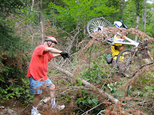
Let’s explore the Pine Barrens in Madison. This area is New Hampshire’s last intact example of a pitch pine/scrub oak woodland, a globally rare forest type. The main trails are wide, firm(if a bit sandy) and flat. There may be a section of the West Branch Trail that is wet due to the recent rains. So expect a bit of mud and a walk through this area. There will be a couple of trail segments that are more like simple single track than the main wide trails. We should cover about 10 miles in two hours or so. This ride is suitable for an experienced and confidant advanced novice. We’ll stop for lunch at Silver Lake.
Directions: Take Route 16 south of Conway to the intersection of Route 113 at Coleman’s. Take a left and follow 113 through Madison. After you see Silver Lake on your left, Route 41 will diverge to the left. Follow Route 41 for 3.4 miles along the western side of the lake. The Nature Conservancy entrance and sign will be on the left directly opposite Black Birch Road. Drive in to the kiosk and parking area.
Or take Route 16 south to the junction of Route 16 and Route 41 in Ossipee, follow Route 41 north for approximately 2 miles, crossing into the Town of Madison. The entrance to the preserve will be on the right side of the road, marked by a TNC sign.
Please be ready to ride at 9:30am.
Sunday, August 23, 2009
Whitaker and Shedd Woods and Pudding Pond
Tuesday, August 25th Ride
Last week we made the journey to Littleton for a very successful ride so let's ride closer to home this week. And what could be more in the heart of the valley than North Conway? We'll never be more than a few blocks from Route 16 but what a difference those few blocks make. This route will allow us to explore Whitaker Woods, Shedd Woods, trails along The Saco and the trails leading down to The Pudding Pond Conservation Area. We'll also do a loop in the conservation area as well as try out the new pump track.
An experienced novice could handle these trails which are mostly dirt double track or wide dirt paths. With all of this weekend's rain there will be a mud puddle or two especially as we ride between Cranmore and Pudding Pond. Expect to cover about nine mostly woodsy miles.
ADDENDUM 8/24/09: As an optional extra we can add on a ride through Whitaker Woods to the Scenic Vista (and back) for an ice cream at Trail's End Ice Cream. This will add about 4 miles to the ride.
I had hoped to do the Sawyer River Trail this Tuesday, but parts of it are under water as a result of the recent rains and some beaver activity. Hopefully we'll be able to do this route later. It is especially beautiful in foliage season.
Meet at the Whitaker Homesite parking lot across route 16 from White Mountain Oil. Be ready to ride at 9:30am.
Sunday, August 16, 2009
Ammonoosuc Rail Trail Adventure
Tuesday August 18th
Let’s take a ride on the B & M Railroad. Well, actually this abandoned rail line has been turned into The Ammonoosuc Rail Trail. It is now a multi-use rail trail that runs about 20 miles between Woodsville and Littleton along the Ammonoosuc River. We'll ride from Littleton to Sugar Hill for about 16 miles out and back, on this almost flat route which wends it's way through woods and farm lands by the Ammonoosuc River. A month ago I rode the Lisbon to Bath section of the trail and it was a delight. However we'll be discovering this section out of Littleton together. Not to fear! At the beginning of this month I checked in with Dave Harkless at The Littleton Bike Shop and he assured me that the trail is in fine shape. There may be some ATV or dirt bike riders that will be on the trail with us, although I don't expect there will be many of these vehicles on a week day.
So why go to Littleton? Because it's a neat little town. After we ride we can visit Bishops Homemade Ice Cream Shop. Yankee Magazine rated it one of the top five ice cream stands in New England. Need I say more? Also there's Chuttters which boasts the "worlds longest candy counter". Even if your not a big candy fan it is quite a sight and worth a visit. Then there's Miller's Cafe and Bakery, their pastries look yummy.
Once you satisfy your sweet tooth you can feed your brain at the Village Book Store with "the largest selection in the north country". Or you could visit the historic Thayers Inn which was built in 1850. Common areas and a couple of rooms are open for viewing. Five Presidents and countless celebrities and national politicians have been guests at Thayers Inn. Then there's the Littleton Grist Mill which is a restored 1798 working mill and museum. All of these attractions are in the bustling downtown area and are a short walk from our cars which will be parked behind the Littleton Bike shop in their parking lot.
Directions: Take route 302 northwest to Bethlehem and get on route 93 north. At exit 41 head north on 302 toward downtown Littleton. In about .75 mi. The Littleton Bike Shop will be on the left. It is 23 Cottage Street (route 302). Take the driveway/road just before the bike shop building and park in back.
Carpooling: Meet in the Attitash parking lot at 8:10.
Be ready to ride at 9:30 in Littleton
 MapMyRide.com" src="http://www.mapmyride.com/images/btn_view_interactive_map.gif">
Let’s take a ride on the B & M Railroad. Well, actually this abandoned rail line has been turned into The Ammonoosuc Rail Trail. It is now a multi-use rail trail that runs about 20 miles between Woodsville and Littleton along the Ammonoosuc River. We'll ride from Littleton to Sugar Hill for about 16 miles out and back, on this almost flat route which wends it's way through woods and farm lands by the Ammonoosuc River. A month ago I rode the Lisbon to Bath section of the trail and it was a delight. However we'll be discovering this section out of Littleton together. Not to fear! At the beginning of this month I checked in with Dave Harkless at The Littleton Bike Shop and he assured me that the trail is in fine shape. There may be some ATV or dirt bike riders that will be on the trail with us, although I don't expect there will be many of these vehicles on a week day.
So why go to Littleton? Because it's a neat little town. After we ride we can visit Bishops Homemade Ice Cream Shop. Yankee Magazine rated it one of the top five ice cream stands in New England. Need I say more? Also there's Chuttters which boasts the "worlds longest candy counter". Even if your not a big candy fan it is quite a sight and worth a visit. Then there's Miller's Cafe and Bakery, their pastries look yummy.
Once you satisfy your sweet tooth you can feed your brain at the Village Book Store with "the largest selection in the north country". Or you could visit the historic Thayers Inn which was built in 1850. Common areas and a couple of rooms are open for viewing. Five Presidents and countless celebrities and national politicians have been guests at Thayers Inn. Then there's the Littleton Grist Mill which is a restored 1798 working mill and museum. All of these attractions are in the bustling downtown area and are a short walk from our cars which will be parked behind the Littleton Bike shop in their parking lot.
Directions: Take route 302 northwest to Bethlehem and get on route 93 north. At exit 41 head north on 302 toward downtown Littleton. In about .75 mi. The Littleton Bike Shop will be on the left. It is 23 Cottage Street (route 302). Take the driveway/road just before the bike shop building and park in back.
Carpooling: Meet in the Attitash parking lot at 8:10.
Be ready to ride at 9:30 in Littleton
Tuesday, August 11, 2009
Tuesday August, 11th
It's a Go ! We had a shower go through at 6:30am and it's gone now. The radar doesn't show any areas of precipitation that are headed our way. So let's go ride. We'll be on roads so drainage shouldn't be a problem. And the rain that fell may inhibit the dust on the dirt road. See you there.
Monday, August 10, 2009
WILD RIVER RIDE
Tuesday, August 11th
The Wild River Valley is a beautiful place to escape the heat and the crowds of mid August. Our route will take us along the lovely Wild River on the tree covered Wild River Road. This is a smooth dirt Forest Service Road which follows the river upstream for 5.7 miles to the Wild River Campground. Then it enters The Wild River Wilderness Area where bikes are not allowed. We may encounter a few cars on this road, but weekday traffic will be very light. After checking out the campground we'll turn around and head back. Only then will we notice, as we fly back, that the road isn't as flat as it seemed when we we're riding upstream. For those of you who have been looking for an easy ride to develop your skills this is it. No excuses! Get out and ride this gorgeous route!
If the weather holds we can ride south on route 113 for 4 or 5 scenic and woodsy miles (until the hills into the notch get serious). When we return to the parking lot there will also be an opportunity to visit the suspension bridge over the river and explore the other side on foot or with bikes.
Meet in the Forest Service parking lot at the intersection of route 113 and Wild River Road. Be ready to ride out at 9:30am.
Directions: Go to Gorham on route 16. At the route 2 intersection go right toward Maine. When you get to route 113 go right and drive about 3 miles to the intersection of Wild River Road. Go right again and you'll see the parking lot. This a fee parking area if you don't have a parking permit you can leave the day fee or park on route 113 just north of Wild River Road. For some of you it may be more convenient to pick up route 113 in Fryeburg and take it to our starting point. If anyone wants to carpool meet at the Jackson Old Town Hall parking lot across from the post office at 8:20am.
The forecast for tomorrow is iffy (what's new) so be sure to check this blog at 8:00am if the conditions look sketchy.
Sunday, August 2, 2009
Are You Ready for a Little R & R ?
August 4th Ride
R & R stands for Rec Path and Redstone Quarry. We'll do the Conway Recreation Path loop and then explore a bit of the Redstone Quarry. The Rec Path saunters along the Saco River and then heads through the woods to The Mineral Springs site where the new high school is located. We can do a lap around the football field, visit the Mineral Springs Pagoda and then hop on the path down to route 302 by the old quarry barracks.
Next we'll bike the length of Mountain Street and enter the trail network leading to the quarry. Here we'll see old structures and machines that the woods are reclaiming. We'll also walk up a path and get great views out over the piles of quarry reject rocks. Depending on the bug and mud factors, we can explore some of the trails near the quarry or go back down by the Saco to extend the ride and have lunch by the rushing waters.
The main surface will be dirt and there are tree roots in a couple of places. Also we'll ride over one short section of loose gravel by the railroad tracks which our route will parallel briefly. This ride is suitable for all abilities.
Meet at the canoe launch parking lot at the end of the road behind the Conway Police Station which is located at the intersection of Route 302 and East Conway Road. We'll start the ride at 9:30am.
See you there for a little R & R.
Sunday, July 26, 2009
A Sunny Forecast - Yeah!
Gale River Rail Trail and Forest Loop
Wow a sunny forecast! Let's take this opportunity to do some exploring outside the confines of the valley. I've discovered a little known rail trail that parallels Trudeau Road in the National Forest in Bethlehem. Even better, this trail intersects one of Marty Basch's rides, the Gale Forest Loop, see page 146 of his book "The White Mountain Ride Guide" 2nd edition.
So put them together and what do you get? A 10 mile route which goes through the forest, along a portion of the Gale River and by scenic beaver ponds with great mountain vistas. Not a bad combo eh? The surfaces vary from dirt to grass with some sections of gravel. This ride is on the "harder side of easy" mostly due to the uphill portion of the forest loop. Feel free to join me in a short bike walk as we ascend to the top of the loop. The uphill is worth it though, as the next couple of miles are really fun.
The forecast is for temps in the mid 80s. It should be cooler in the woods. We will start the ride at 9:30 am sharp. Our trail head is just off route 302.
Carpooling - Meet at 8:30 am in the Attitash parking lot across the street from the lifts.
Directions - Take route 302 to Twin Mountain. Continue 5.0 miles north of the intersection of routes 302 and 3. Just past The Wayside Inn (which is on the left) is Muchmore Road. Go left and follow Muchmore Road for 0.1 mi as it bends around to the south. When the road pavement ends hook a U turn to park on the opposite shoulder by the old and closed blue bridge over the Ammonoosuc River. Park just south of the yellow fire hydrant.
Sunday, July 19, 2009
A Valley Classic
Rob Brook Road Loop - Tuesday July 21st
The rains have subsided for the most part, so it's time to do a valley classic, The Rob Brook Road Loop. This does include a crossing of the Swift River towards the end of the ride and your feet will get wet. I checked out the crossing point on Saturday and it looks good. This is a 12 mile ride, suitable for all abilities, mostly on a winding dirt forest road with the last few miles on the Kanc and Bear Notch Road. There are hills to climb and they are quite doable. The last hill is just before we get back to our cars and I'll be happy to walk up that one with any others who are so "inclined".
You can find a more complete description of the route on pages 36 to 38 of Marty Basch's "The White Mountain Ride Guide" 2nd edition. A good lunch spot is at The Russell Colbath House (on The Kanc) where there are picnic benches by the barn.
The Trail Head and parking are on the west side of Bear Notch Road .75 mi north of the intersection with The Kanc. This is not a fee area of The White Mountain National Forest these days. Humid air is headed our way so let's get an earlier start. We will leave the parking area at 9:30 sharp.
Monday, July 6, 2009
Tuesday July 14th Ride
Gorham to Berlin on the Rail Trail - We've explored two sections of the Presidential Rail Trail and we have one section left to go. This scenic segment runs from the parking lot in Gorham on route 2 to Berlin along the east (quiet) side of the Androscoggin River. This lesser know rail trail has several interesting features. Along with getting great views of the Androscoggin we'll skirt a gravel pit, go over the very high trestle bridge across route 16, bike by the hydroelectric powerhouse and dam on the canal adjacent to the Androscoggin, view the Cascade Flats complex and dam from the seldom seen east side and visit a waterfall, if I can find the side trail again.
When I took this route last fall the surface was varied. It consisted of dirt, ballast, gravel and the occasional mud puddle. There was one section of loose stones that some may choose to walk their bikes across but it was possible to safely ride this section. This 10.5 mile out and back route is appropriate for all abilities. There might be the odd ATV or dirt bike as I saw their tracks but did not encounter one these vehicles. After our return from Berlin we will have the opportunity to explore the 1 mile emergency road which begins across route 2 from our starting point. For those who might want to cover more miles there is the option to ride west on the rail trail too.
The Trail Head and parking is on Route 2 in Gorham. Directions: go north on route 16 to Gorham. When route 16 meets route 2 at the T intersection turn left. Go through Gorham on Routes 16 and 2 until Route 2 diverges to the left at the traffic light . You'll see the trail head parking lot on the right about .8 miles after you turned left on route 2. For those of you who want to carpool meet at The Old Town Hall in Jackson, across the road from the post office at 9:00am. Be ready to ride at 10:00am at the trail head in Gorham and hope for a beautiful sunny summer day.
Want to view a map of this ride? Click below.
http://www.mapmyride.com/ride/united-states/nh/-gorham,-nh/451124594135949120
Next weekend Marty Basch will present an entertaining look at life from the seat of a bicycle on Saturday, July 18 at 7 PM at the Whitney Center in Jackson. Marty has recently published a second edition of the popular The White Mountain Ride Guide which includes both road bicycling trips and mountain bike trails. This program is free.
Sunday, July 5, 2009
Stay Tuned
Presently the chance of rain for Tuesday is 60%. So check back tomorrow night. We may be able to ride Tuesday morning before the instability in the atmosphere creates showers. Tough telling not knowing.
Tuesday, June 30, 2009
Let's Go
It looks like we will have a window of opportunity this morning to ride. So let's get out there while we can. One report even says that we'll see blue skies when the fog burns off. All Right!
The trails we'll be riding today are by the Saco. The ground there is sandy and it drains quite well. So the trails should be in pretty good shape. During the last week I've been in there a few times and even with all the recent rain the trails were fine.
The trails we'll be riding today are by the Saco. The ground there is sandy and it drains quite well. So the trails should be in pretty good shape. During the last week I've been in there a few times and even with all the recent rain the trails were fine.
Monday, June 29, 2009
Rain Strain
Another forecast with a 50% chance of rain, ergh. Well let's think positively and plan for a ride tomorrow. How about another close to home ride in case we need to bail out (literally) early?
So let's explore the trails around and near Thorne Pond in Bartlett. These fun and virtually flat trails range from logging type roads to single track. While most of the trails are appropriate for an experienced novice, there will, occasionally, be quick turns, roots, stones and mud to ride around or over. There are a couple of spots where getting off the bike may be advisable. There aren't any difficult trails. So we should have a very nice ride.
We'll meet in the back of the Attitash parking lot, across route 302 from the mountain. Park in the back of the lot by the parking shack to avoid using spaces that Attitash customers might need. Be ready to ride at 10:00am.
Rain in the morning will cancel the ride. Check back here tomorrow morning around 8:00am to confirm that the ride is still on.
Monday, June 22, 2009
Tuesday June 23rd Ride
6/23 update...There's blue sky out there - Let's ride! See you at 10:00am.
Although the weather forecast is mixed, with a 50% chance of light rain, I'm feeling lucky. Let's get out and ride. Tomorrow's route will be an exploration of the dirt roads in the Bartlett Experimental Forest for about 5-8 miles (depending on the weather conditions). Then we'll cross over to the east side of Bear Notch Road and do some fun, experienced novice, single track and old logging roads on the Reservoir Brook Trail for 1.5 to 2 miles. We'll never be more than a few minutes away from our cars if it starts to rain and we decide to bail out of the rest of the planned route.
Let's meet at 10:00am, ready to go, in the parking lot off River Road just after it crosses the Saco River in Bartlett. Directions: Take Route 302 to Bartlett, at the blinking light in the center of Bartlett take a right and in about half a mile you'll cross the Saco River and the parking area will be to the left of the bridge.
We will need to shuttle people and bikes up to the top entrance of the Experimental Forest (which is almost at the top of Bear Notch) from the parking area. Then we'll start our mostly downhill adventure. Bring bug spray!
IF IT'S RAINING TOMORROW MORNING THE RIDE IS CANCELLED. Check back here at 8:00am to confirm cancellation.
Sunday, June 21, 2009
Lurking Murk
The weather for Tuesday is not "clear". However the tentative plan is to explore the forest roads in Bartlett's Experimental Forest and the Reservoir Brook Trail. But the weather seems to be up in the "air".
Check back here tomorrow night for more info and/or a more specific description of the ride if the weather looks acceptable.
Best Wishes, Joan
Check back here tomorrow night for more info and/or a more specific description of the ride if the weather looks acceptable.
Best Wishes, Joan
Sunday, June 14, 2009
A Hidden Jewel
A few years ago I was researching possible ride routes along the Presidential Range Rail Trail. None of the many maps and books I had (nor any of the websites I could find) was specific about the western terminus of the trail. So I organized a scouting group with Marianne Borowski and Glenn Ashworth and we went to the Pondicherry National Wildlife Refuge in Whitefield and Jefferson to explore. What we found was a gem, an incredibly beautiful place. Oh and we also found the western terminus of The Presidential Range Rail Trail.
So, now it's your chance to discover this beautiful spot. Marianne has chosen a really nice ride for you on Tuesday and I highly recommend it. Don't forget your camera!!!
Kudos to Marianne for her hard work! The following is her write up.
Lupine and Pondicherry by Rail Trail and Valley Road
The weather forecast looks great for Tuesday!
Let's do a scenic view ride in the Randolph-Jefferson valley area.
The route follows the Presidential Rail Trail for most of the way. It starts at the Bowman parking area (hikers parking for the Castle trail) on the left (south) side of Route 2.
From the Conway area, drive north over Pinkham Notch on route 16. Take a left onto Route 2, drive though town then take a left again on Route 2 as it heads west towards Randolph. Drive ~8.4 miles to the Bowman Castle Trail parking area, on the left. It is about 3 miles west of the Appalachia trail head parking area.
We will ride the rail trail for 2 miles and then cut over to Valley Road which is a smooth, scenic dirt road. The lupine were just starting to bloom in the fields last Monday, and if the rain hasn't hurt them, they should still provide a nice display for us as we ride by.
After 3 miles on Valley Road, we reunite with the rail trail again at its intersection with route 115 and follow it 4.5 miles into the Pondicherry Wildlife Refuge. This area has great scenery and panoramic views of the Presidentials. Magazine-worthy photographic opportunities. On the return, we can retrace our route or ride some pavement on Israel's River Road as a change of venue for awhile.
Total Mileage out and back: ~18.5 flat miles
Start time: 10:00 am, ready to ride .
For those heading to the Bowman parking area and wish to carpool, meet at the JacksonXC/Wentworth GC parking lot directly across from the J-Town Deli at 8:55am.
Bring water, lunch, camera and bug defense. A mountain bike is best for riding this relatively soft rail trail which often has short sections of coarse gravel.
For a map, click this link:
http://www.mapmyride.com/ride/united-states/nh/randolph/275124485600141373
Need more miles after looking out the window at the rain lately? If the weather is good, does anyone want to start at 8:30 to ride from the Pinkham B Road? This will add 18 miles to the day, adding a climb on Pinkham B and a ride on Durand Road, which is parallel to and North of Route 2. Durand Road ends about 1/2 mile before the Bowman trail parking area. Meet the rest of the riders at Bowman ready to ride at 10:00 after this "warm-up". Call or email Marianne for car pooling if you want to do these extra 18 miles: 383-9232 marianneborowski@yahoo.com.
Sunday, June 7, 2009
June 9th Ride
It looks like we'll be in for a period of rain starting Monday night. So the Tuesday June 9th ride is cancelled.
Next week the June 16th ride will be lead by the inimitable Marianne Borowski. She has been scouting out several possible ride routes especially tailored for our group. Check back this time next week to see what Marianne has in mind.
I'm "bugging out" of the valley and going to The Cape. Good by black flies and hello tick capitol of the world. I've got something a little different and special planned for the ride on June 23rd. It promises to be fun for the experienced riders and also fun for those who are newer to off road riding. Yup it'll have something for everyone. So stay tuned.
Happy Trails, Joan
Sunday, May 31, 2009
Old River Frog
Well, we've had a ride in North Conway and one to our north in Gorham and one to our south in Chocorua. So now its time to head east to North Fryeburg on a ride I call Old River Frog. On Tuesday June 2nd, we'll explore the very scenic and less visited area by the old course of the Saco River. A majority of this nearly 11 mile ride will be on Old River Road and Frog Alley. The turn around point will be The Hemlock Covered Bridge. This ride is for all abilities on pretty flat, paved and dirt roads with little car traffic. The views are fantastic and the forecast calls for a bug deterring breeze. For those of you who would like to add a few miles to your route there is the option of doing a 6 1/2 mile loop at the end of the ride.
The meeting place will be at the Scenic Vista (just north of North Conway on route 16) at 9:00am. Carpooling, which I strongly encourage you to do, can be arranged at the Scenic Vista before heading over Hurricane Mountain Road. For those of you who would like to venture to North Fryeburg on your own please email me at chumley@earthlink.net or call me at 383-6192 for the North Fryeburg starting point.
See you soon, Joan
Sunday, May 24, 2009
Chocorua Lake Loop - May 26
The weather forecast looks very good for Tuesday. So let's venture out of the valley to Chocorua. This is one of Bob Houlihan's favorite rides and he will be leading the group this week as I'm in Philadelphia. Below is Bob's description of the Chocorua Lake Loop.
This week I would would like to ride the dirt roads just south of Chocorua Lake in Tamworth. This a relatively easy 12 mile ride with a couple of hills going out Fowler's Mill Road and returning through Hemmingway State Forest. Car traffic is very light on this loop.
Meet at the parking lot on the west side of route 16 at the intersection of Fowler's Mill Road (also known as Chocorua Lake Road). Be ready to ride at 10 AM. For those wishing to carpool meet at 9:15 AM in the back of the parking lot behind the Laconia Savings Bank, which is located at the intersection of route 16 and 153 in Conway Village.
The ride goes out Fowler's Mill Road for 4.7 miles
Left on route 113A
After .1 miles left on Old Mail Road
After 2.3 miles left on Gardner Hill Road
After 1.9 miles left on 113
Then in another .1 left on Philbrick Neighborhood Road
After 1.4 mi right on Loring Road
In another .8 we take a right on Fowler's Mill back to the beginning
If the bugs aren't too bad we can have lunch by the lake.
Sunday, May 17, 2009
Cedar Creek Loop De Loo
Tuesday morning, May 19th, we will explore the National Forest Trails to the west of the Cedar Creek and Birch Hill neighborhoods off West Side Road in North Conway. I've mapped out two loops which combine about 7 miles of mostly forest roads and about 3 miles of pavement. The total time to do both loops at a moderate pace, without stops, is about two hours. Our group will probably complete the ride in about three hours with water and snack/lunch stops.
The first loop is pretty flat and suitable for all abilities and the second loop is only slightly longer and requires slightly more effort. For those who want a shorter ride I suggest doing the first loop only.
We'll enter The National Forest on a trail from Cedar Creek where there is no street parking allowed. I've arranged for us to park at a friend's house in the area. So let's meet at the parking lot behind the Eastern Slopes Theatre. It's entrance is just off River Road in North Conway.
Please be ready to carpool from the parking lot over to Cedar Creek at 9:30 sharp! Check your tires and bring a snack/lunch. I was on the trails Saturday. Black flies weren't yet a problem, but at one stop I was eyed by a few mosquitoes. Bring bug spray, just in case.
See you Tuesday, Joan
Thursday, May 14, 2009
Presidential Range Rail Trail Ride May 12th
Good Group, Good Trail, Good Fun
According to one group member, "That was a great ride!" and it was. Temperatures were mild and the sky was partly sunny. The group displayed a wide range of biking skills, from the very experienced to the first timer, and this trail suited all of us. The first half of the ride was almost imperceptibly uphill and the return was a "breeze". We all handled the gravel/dirt surface without a problem.
There were numerous moose prints and signs of other four footed creatures including bear, deer, coyote and beaver. A turkey and several broad winged hawks graced us with their presence. Blooms of trillium, pin cherry and hobblebush enhanced the beauty of the scenery.
Check this blog Sunday night ( 5-17) for an update on next Tuesday's (5-19) ride. Thanks to those adventurous souls who ventured out for our first ride.
Happy Trails, Joan
Monday, May 4, 2009
RATS!
The weather prognosticators are not being cooperative. Its going to be cold and wet tomorrow. Rats! So let's postpone the ride to next Tuesday, May 12th. Same time, same route, same place, same plan, just better weather. See you next Tuesday.
To aid in the planning process, could you please send me an email, using the link below, to let me know that you are interested in next week's ride.
Thanks, Joan
To aid in the planning process, could you please send me an email, using the link below, to let me know that you are interested in next week's ride.
Thanks, Joan
Sunday, April 26, 2009
Inaugural Ride
The Presidential Rail Trail from Gorham to Randolph will be the inaugural ride for The Fat Tire Cruisers Group on Tuesday May 5th. This is a wonderful ride, one of my favorites. We'll ride 9 miles, mostly through the woods with beaver ponds and meadows and some beautiful mountain views, to the Castle Trail in Bowman (Randolph) and then return.
This is a ride for all abilities. The surface is mostly dirt or gravel. Wide tires are recommended. Total miles – 18. There are shorter options. A good turn around point for a shorter distance is at the Pinkham B Road (aka the Dolly Copp Road) for a 9 mile ride. Marty Basch’s “The White Mountain Ride Guide”, second edition has a detailed description of this trail and I highly recommend the book.
The Trail Head and parking is on Route 2 in Gorham. Directions: go north on Route 16 to Gorham. When route 16 meets route 2 at the T intersection turn left. Go through Gorham on Routes 16 and 2 until Route 2 diverges to the left at the traffic light . You'll see the trail head parking lot on the right about .8 miles after you turned left on Route 2.
For those of you who want to carpool meet at The Old Town Hall in Jackson, across the road from the post office at 9:00am.
Be ready to ride at 10:00am at the trail head in Gorham and hope for a beautiful sunny spring day.
If the weather is iffy, check back with this blog on Monday night.
Questions? Email chumley@earthlink.net
Subscribe to:
Posts (Atom)